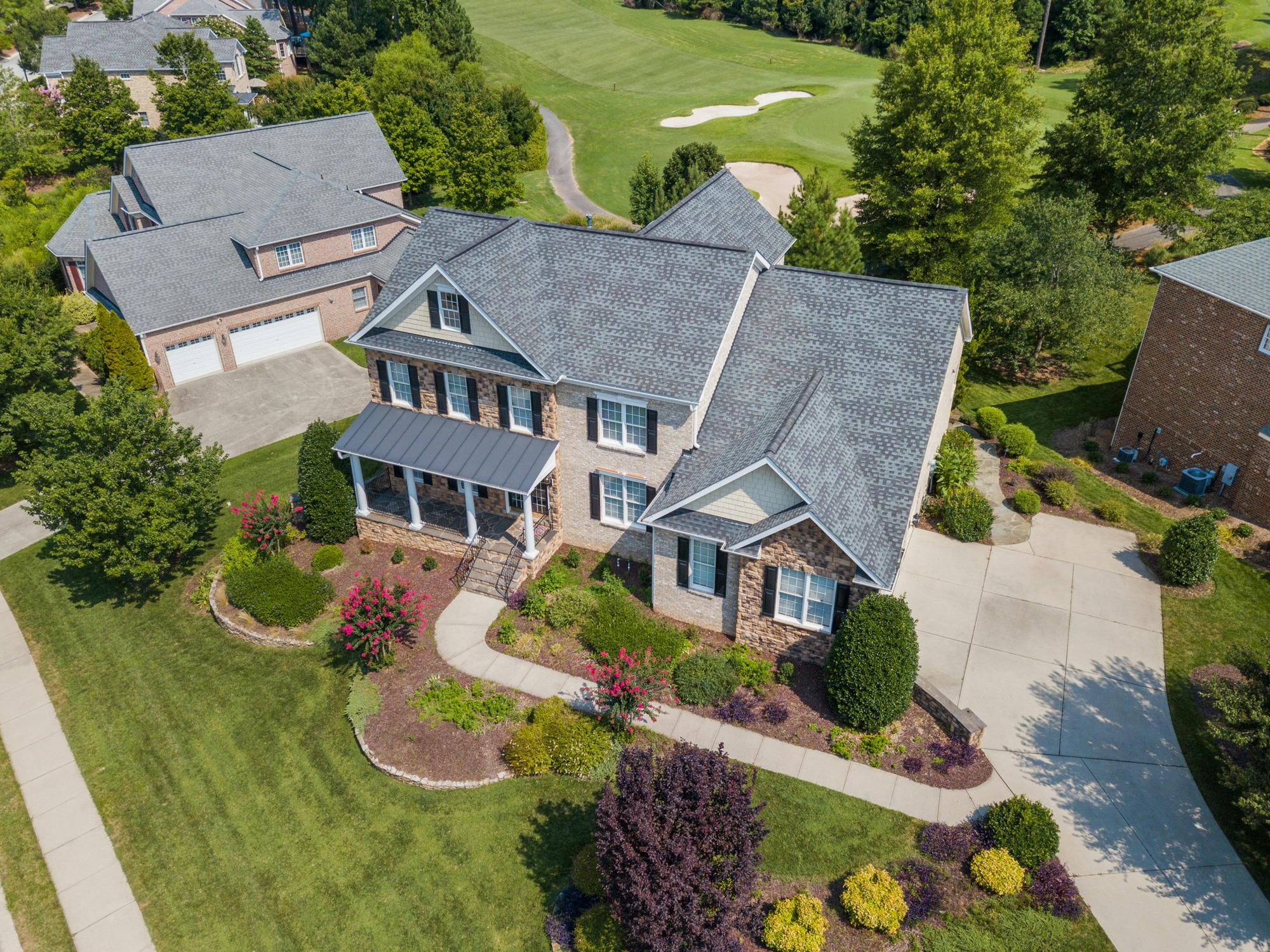
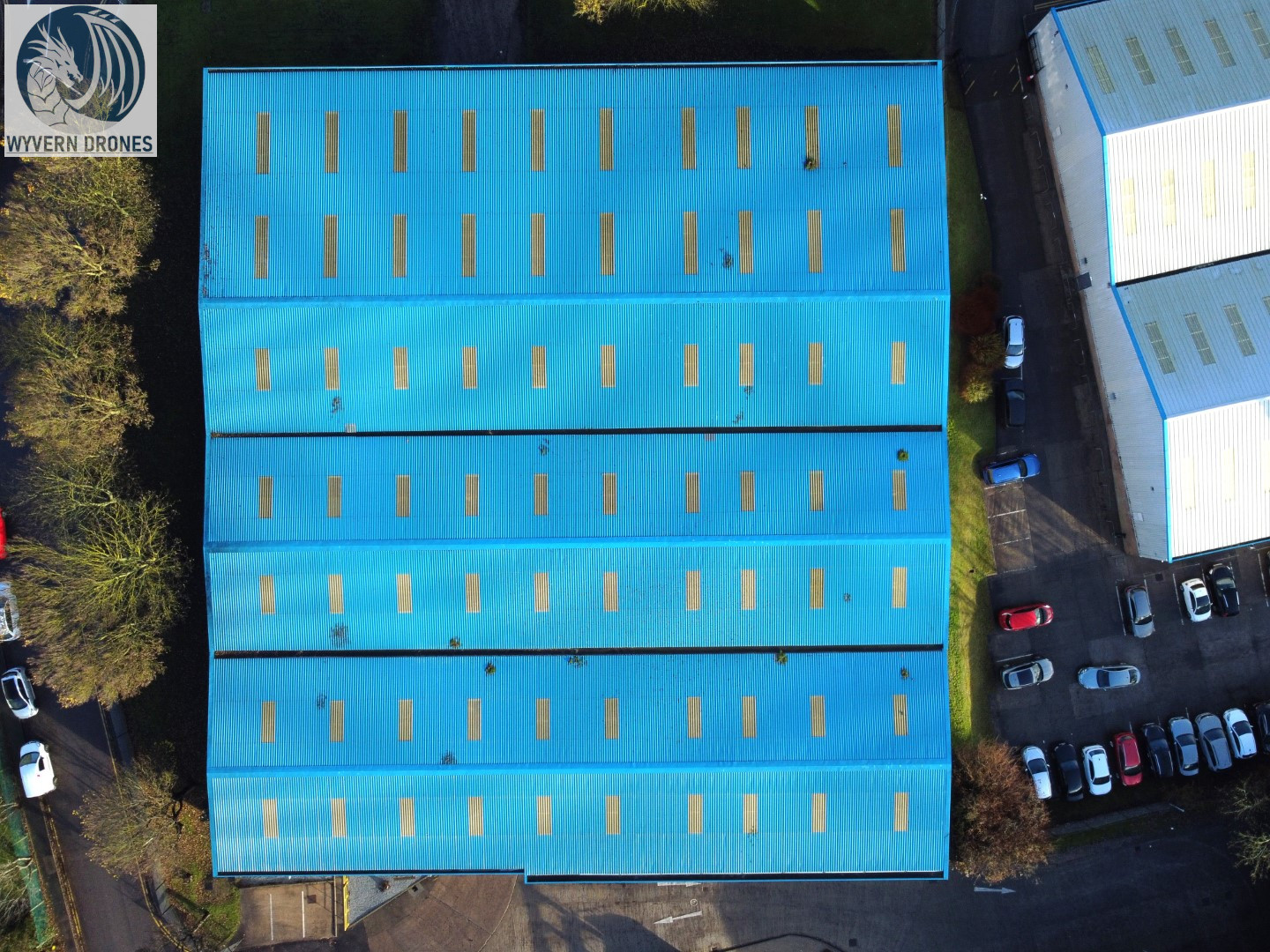
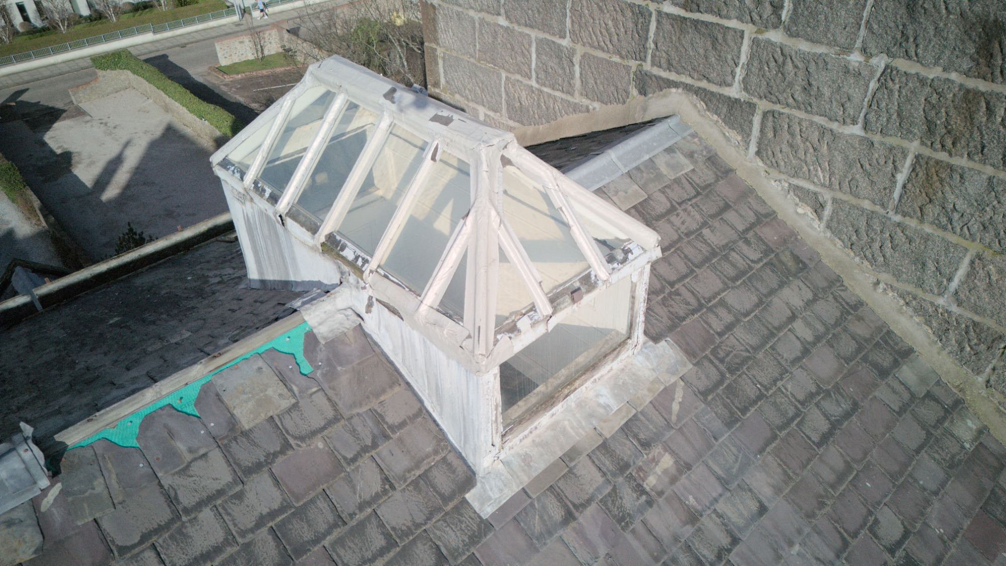
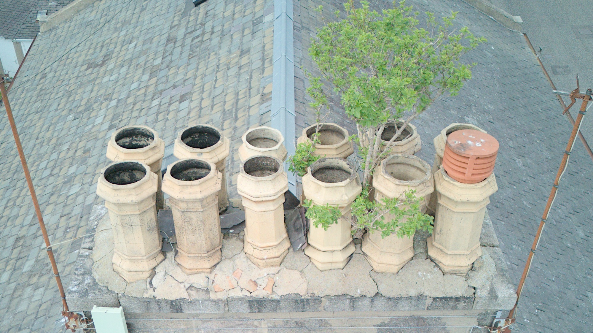
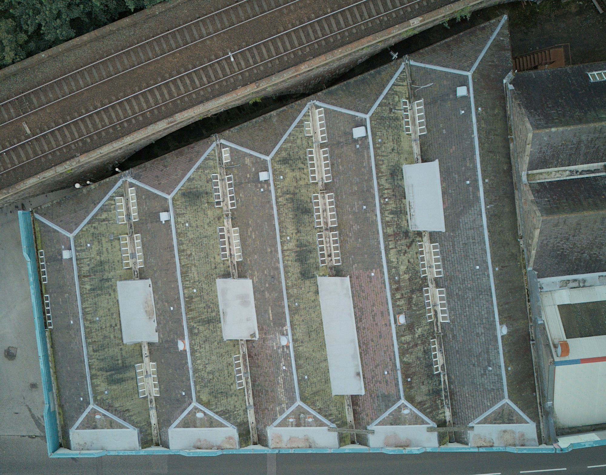
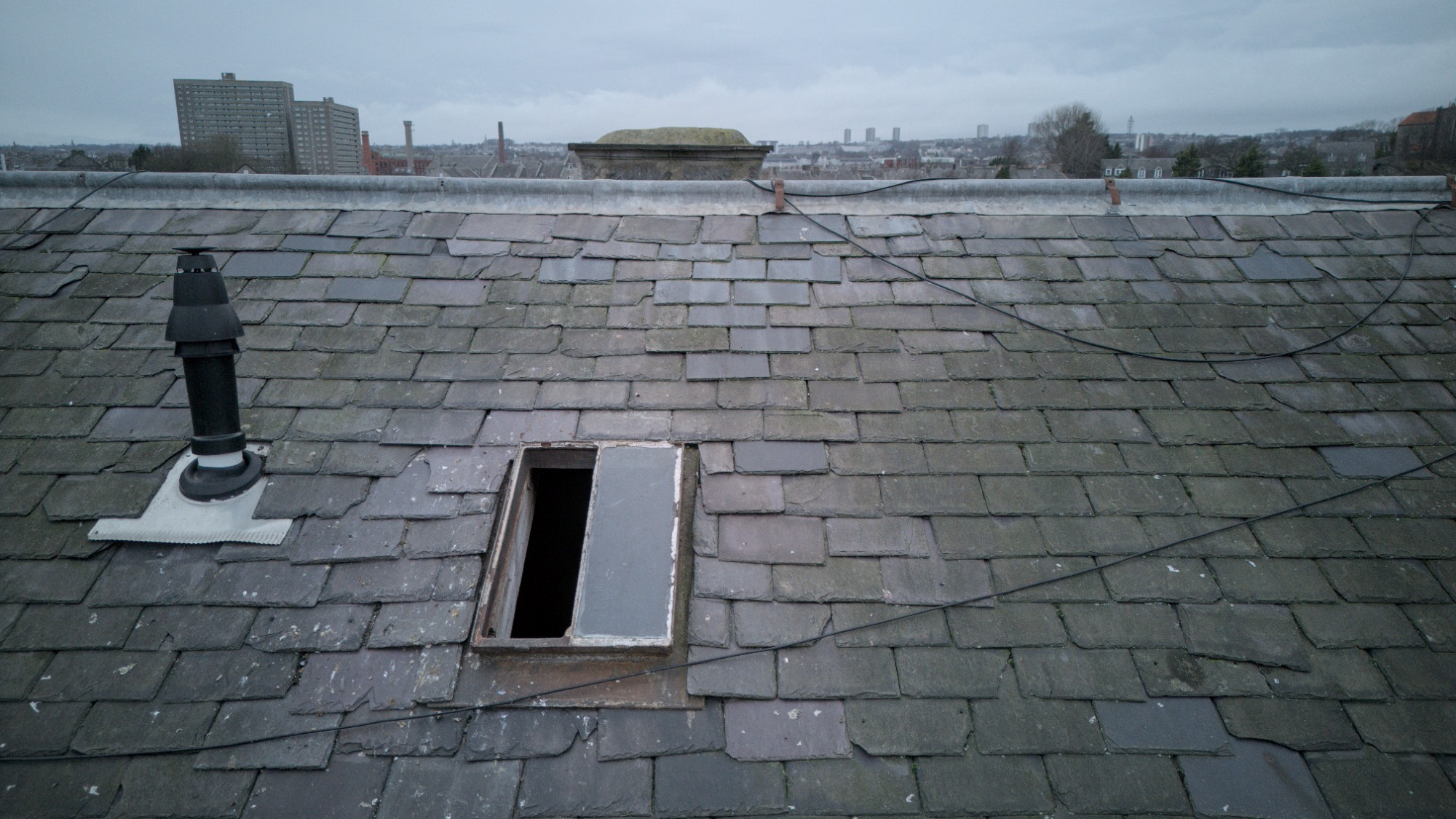
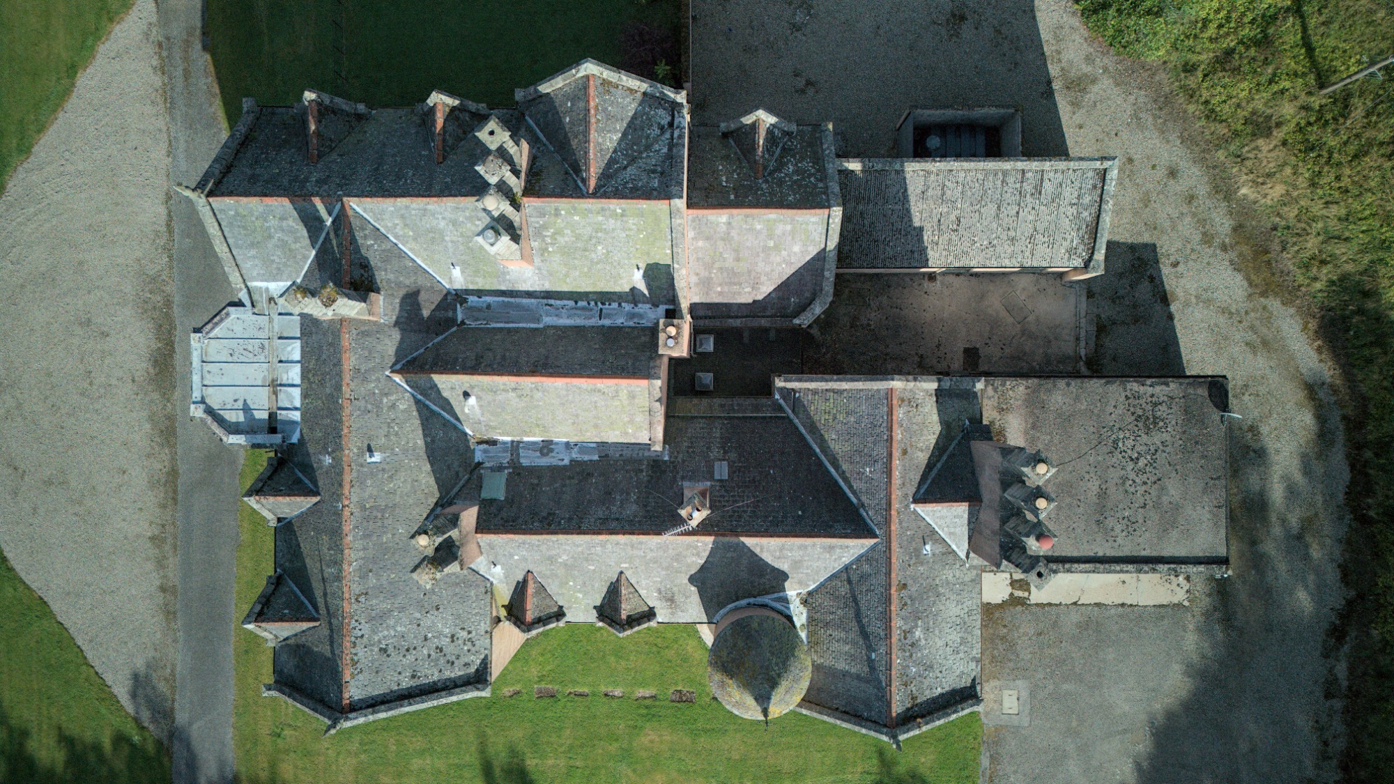
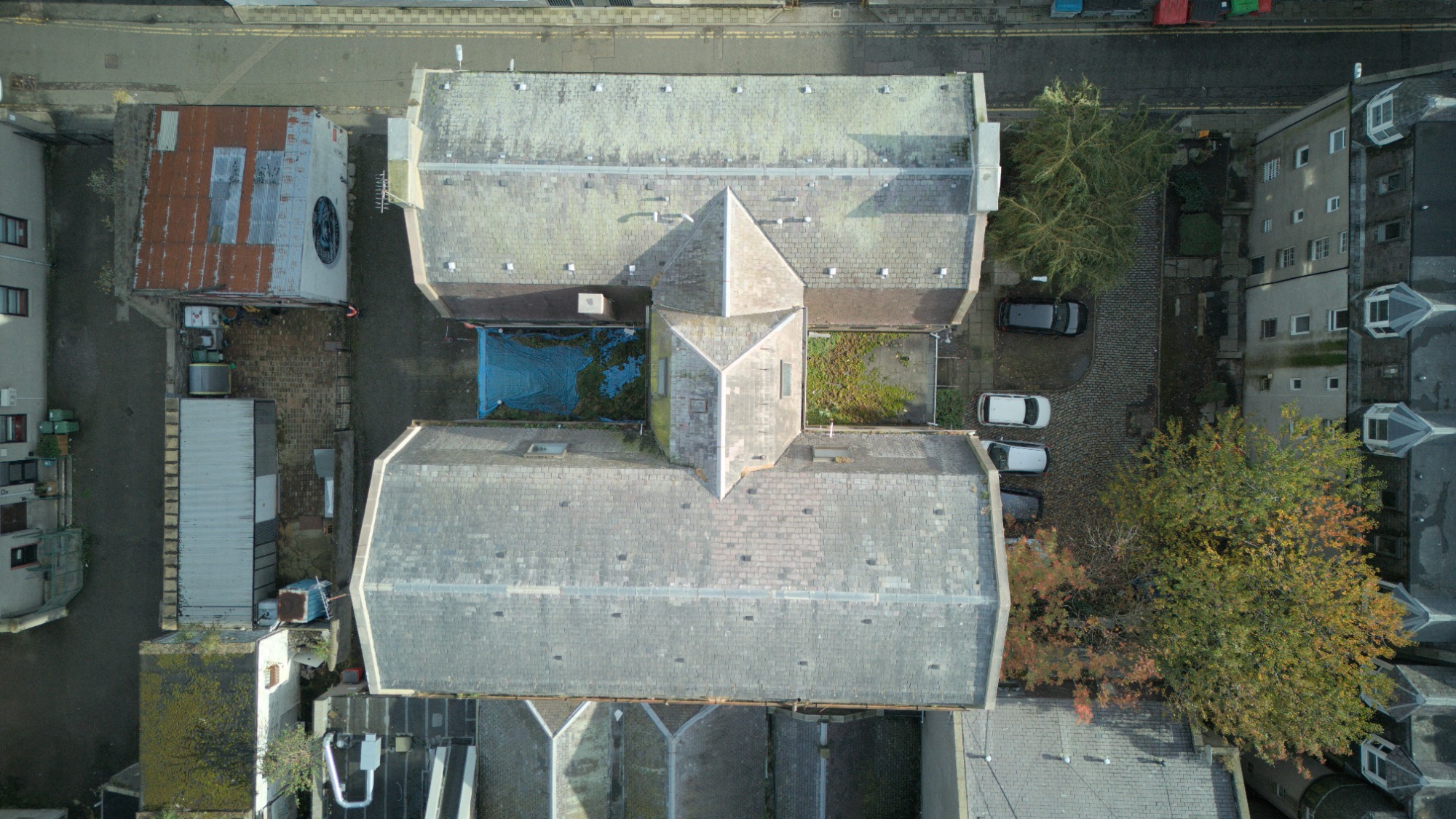
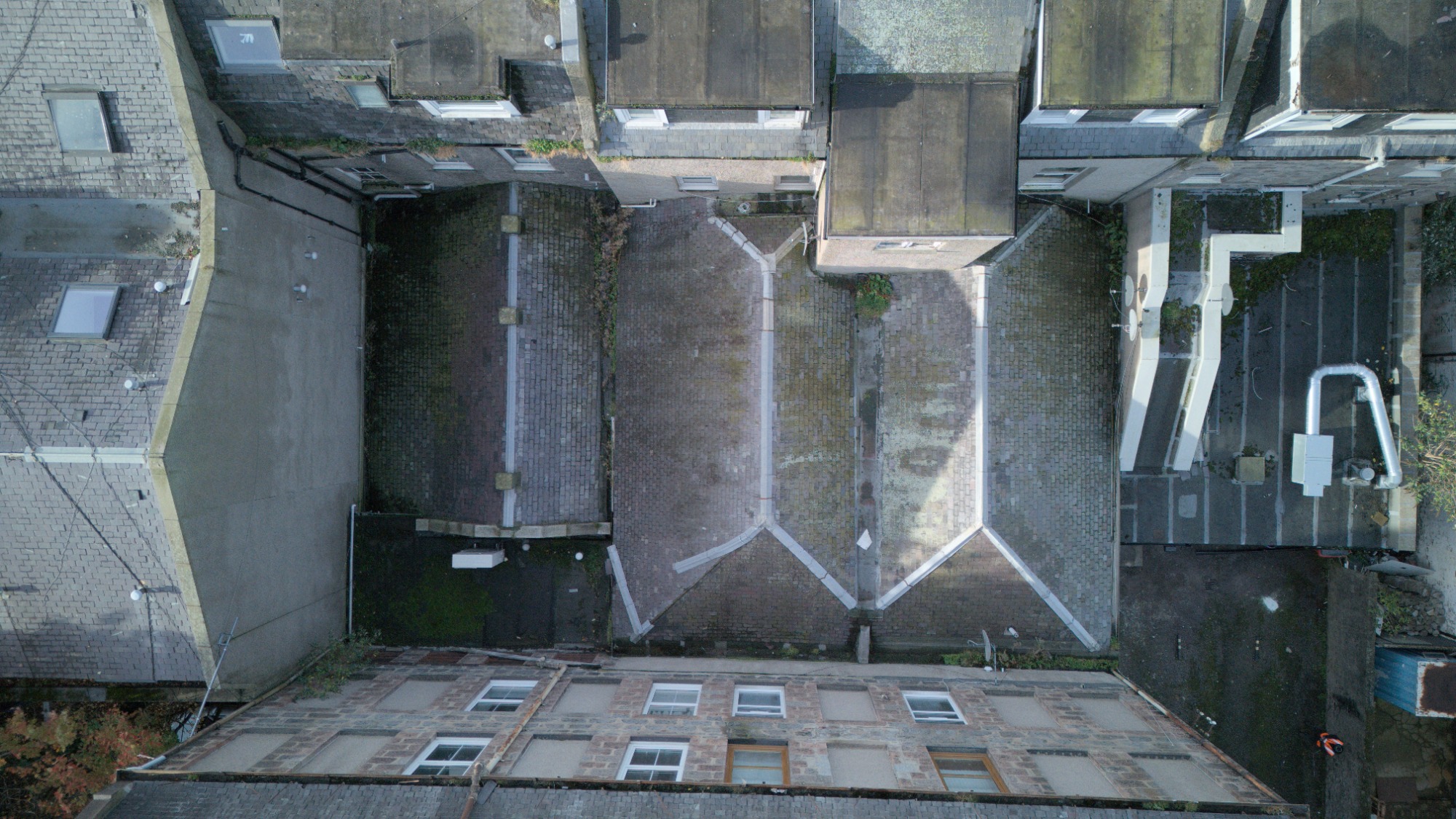
Roof Drone Inspections
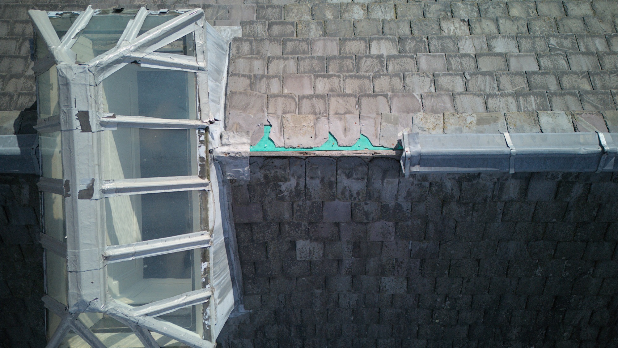
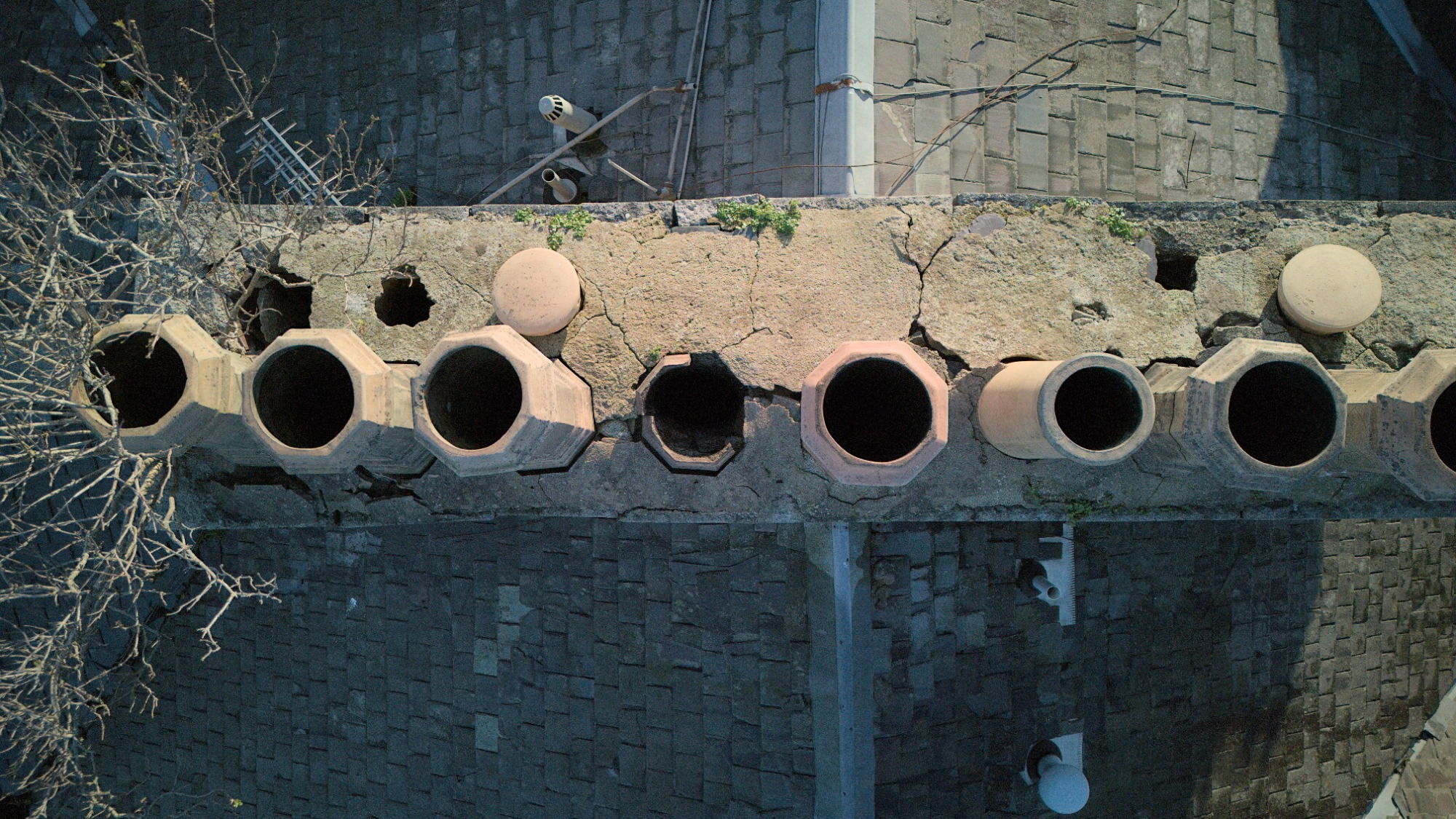
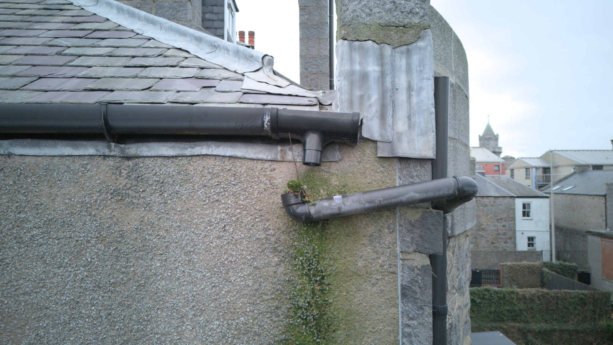
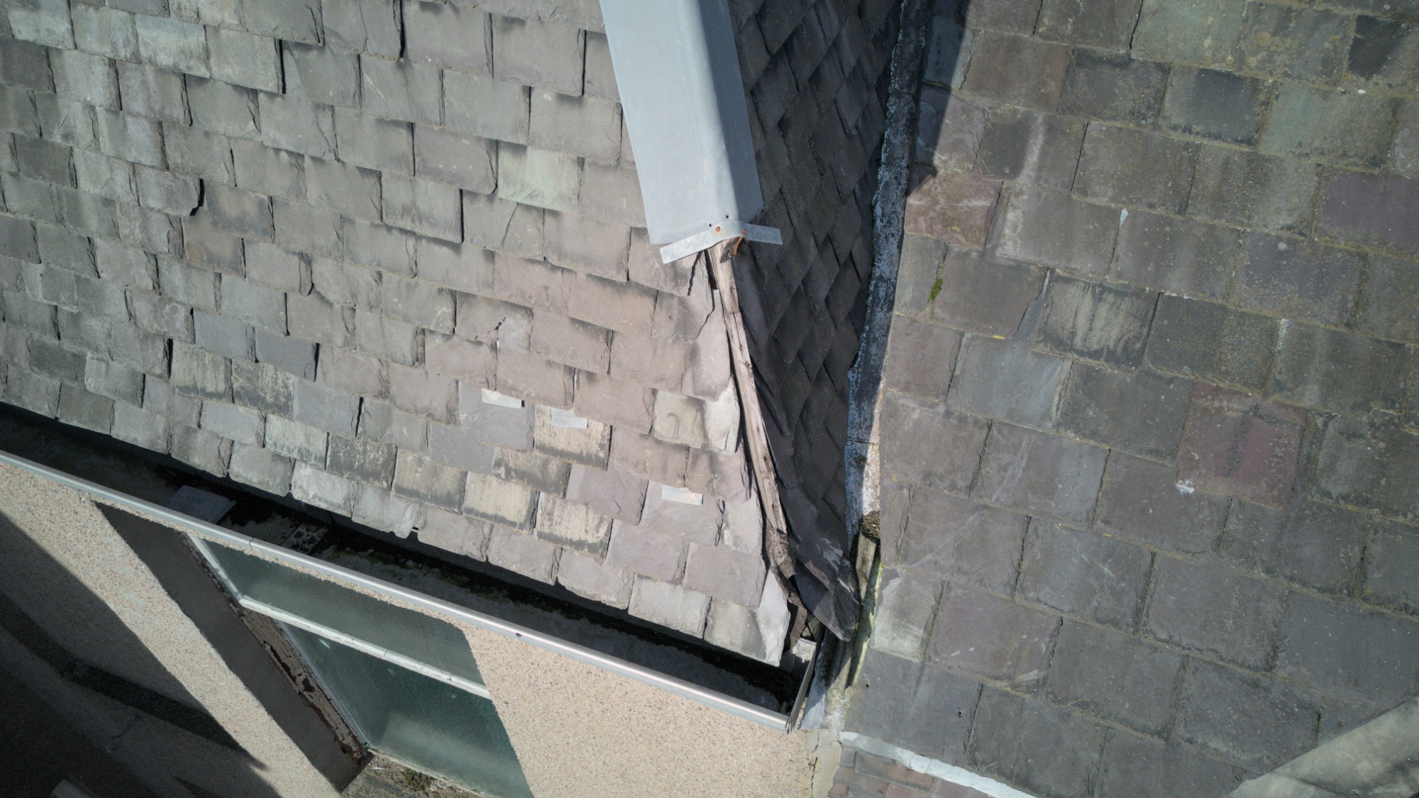
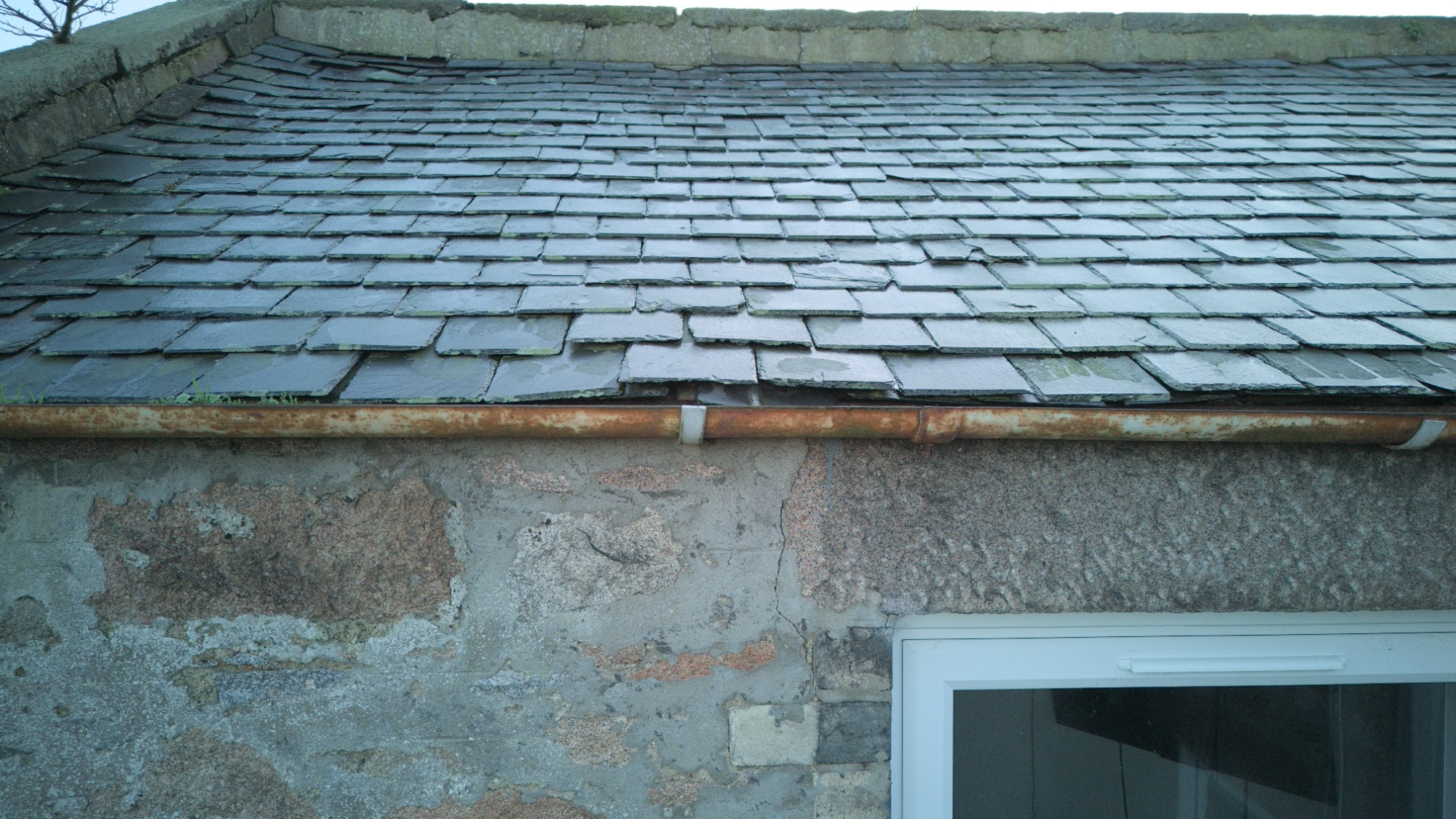
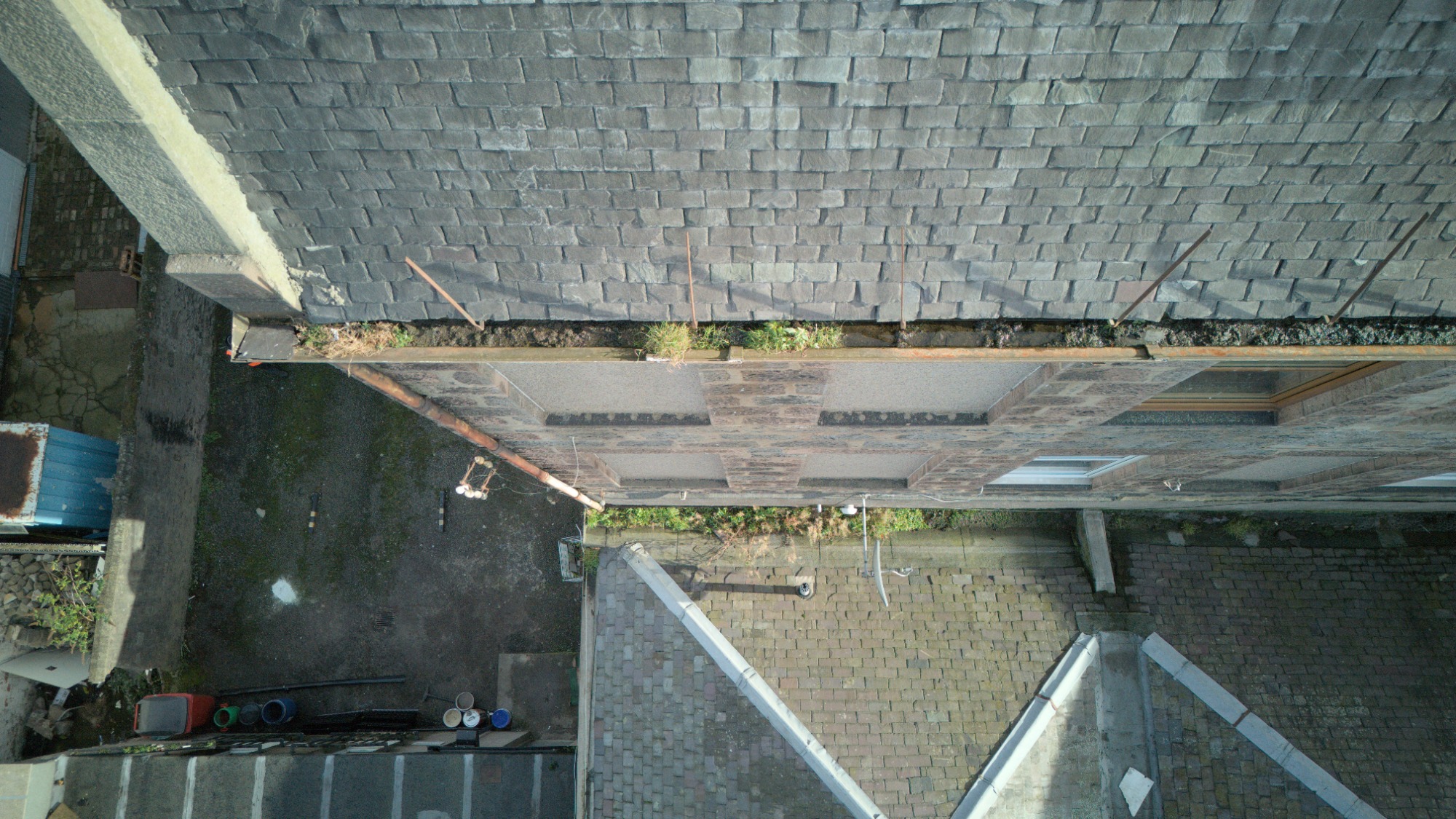
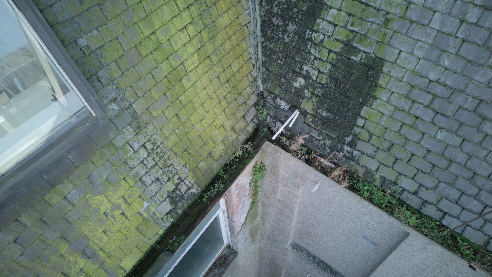
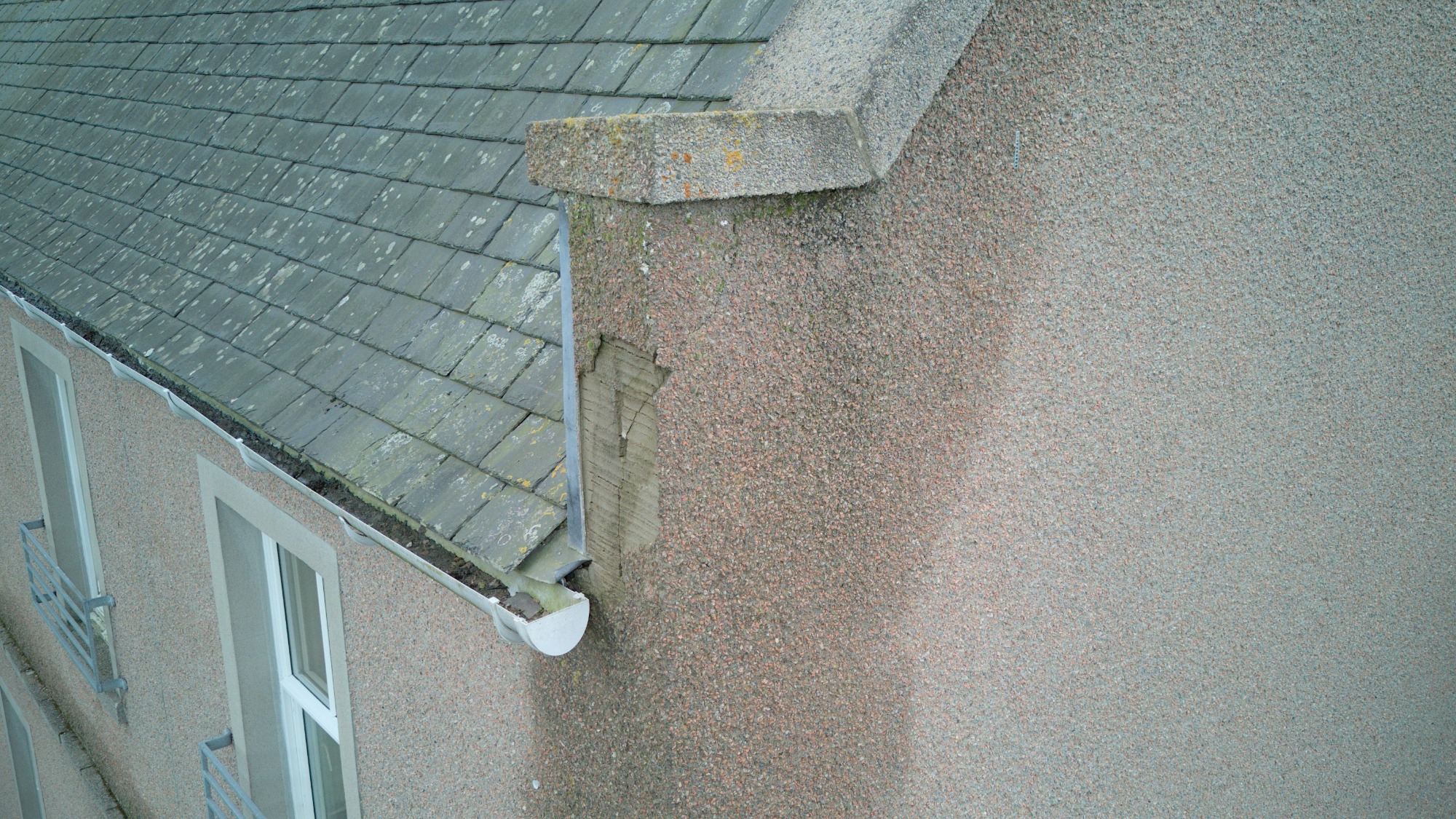
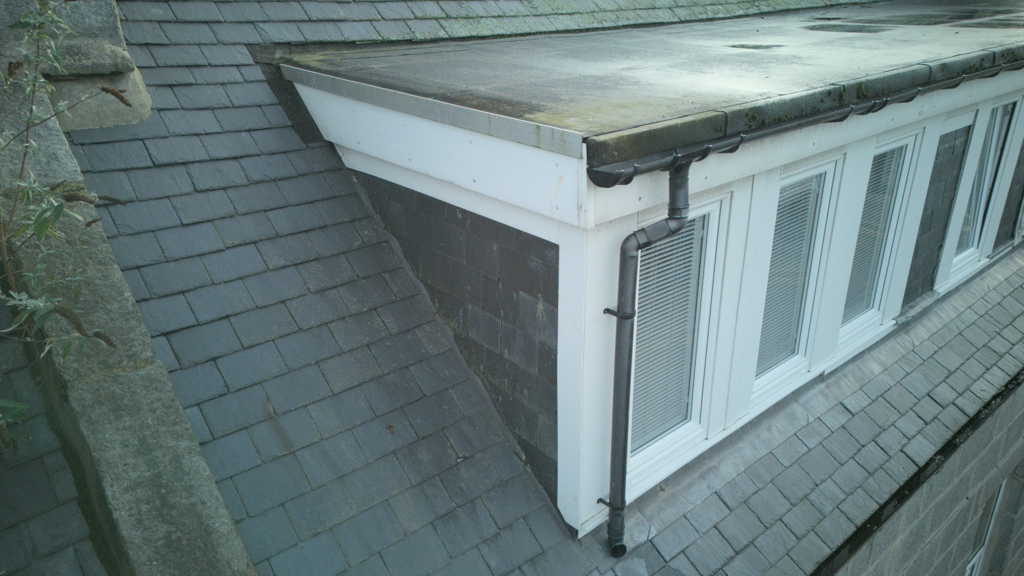
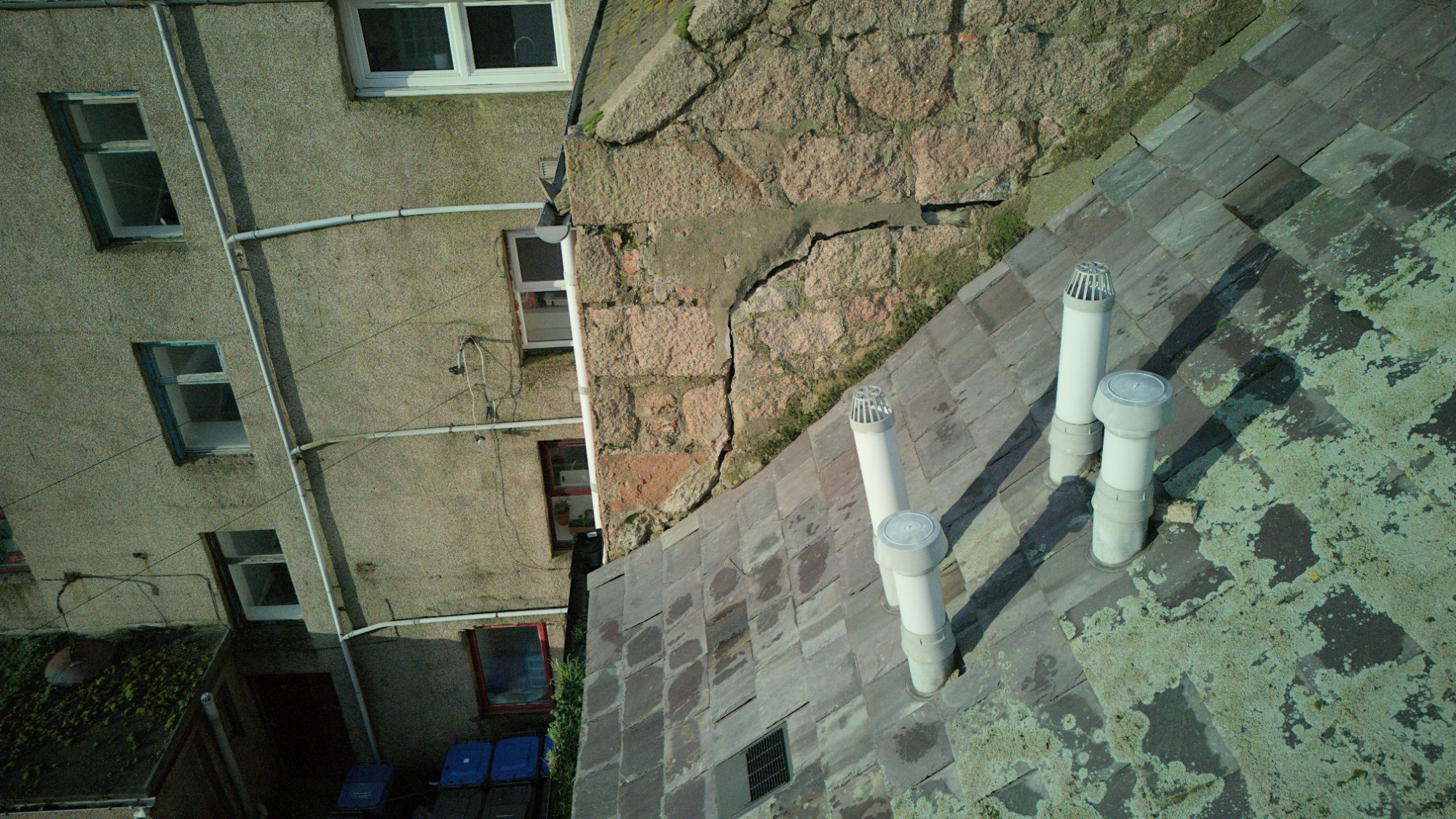
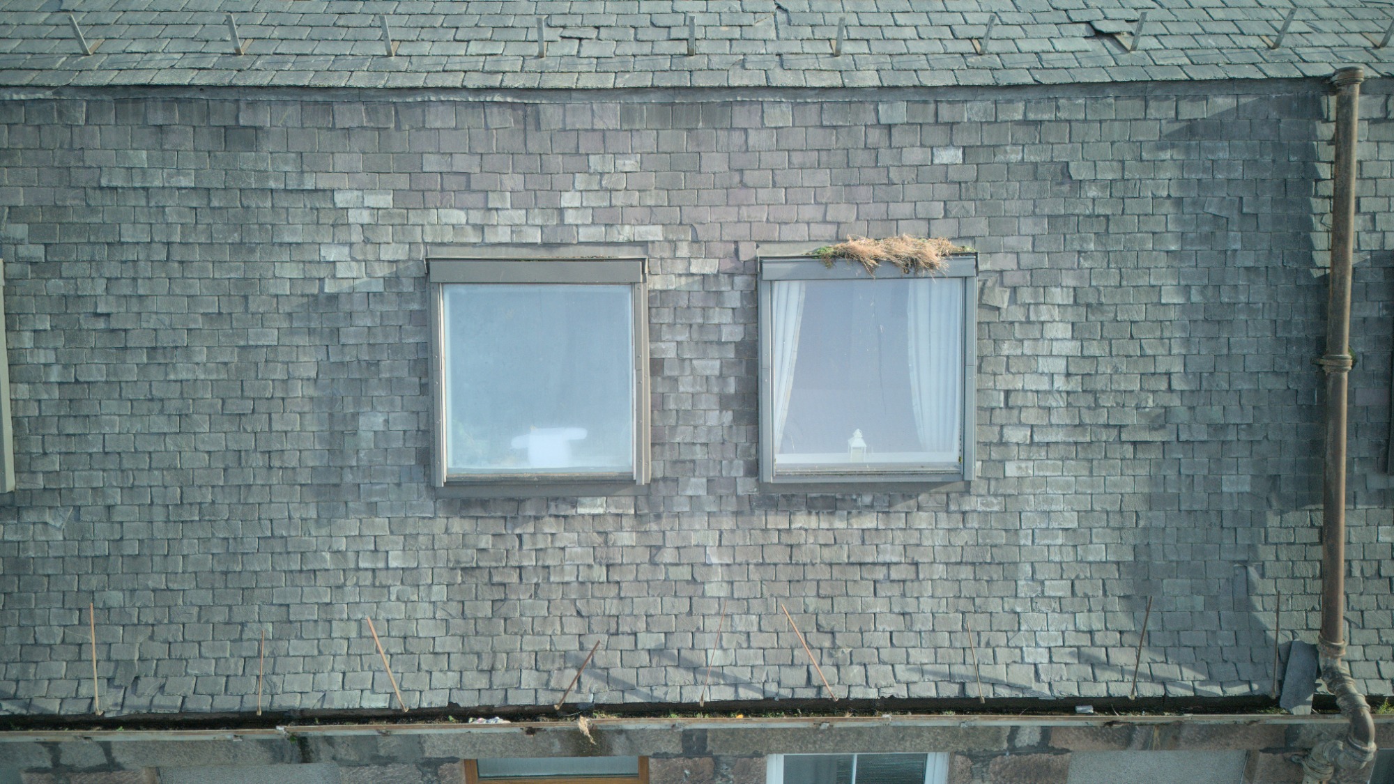
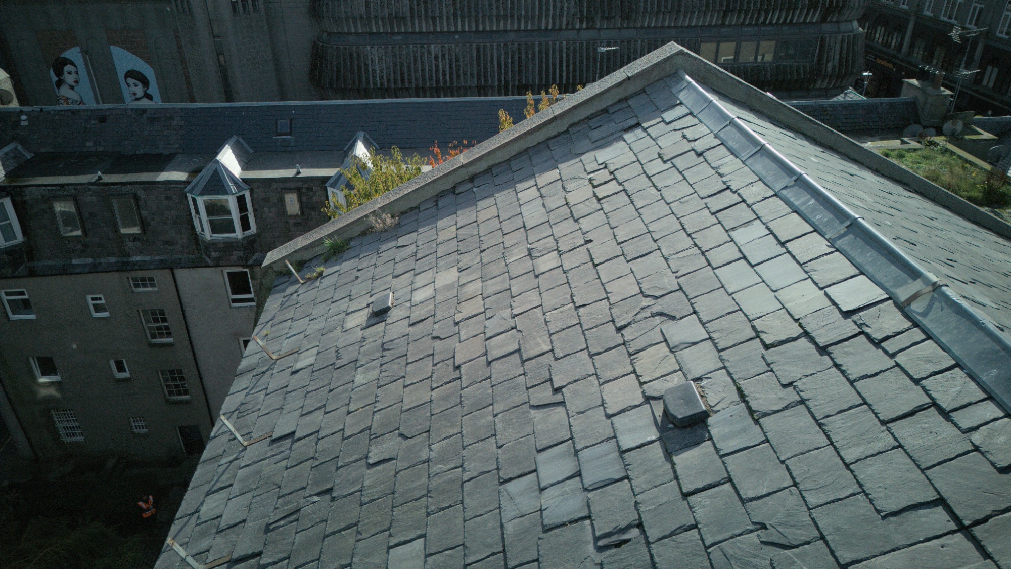
Drone surveys of roofs, gutters, fascia's, chimneys and hard to reach spots provide high resolution images that help identify issues early, saving time and costs for property owners. Drones can quickly and easily cover large areas of roof, capturing data in a fraction of the time it would take with traditional methods. This minimizes disruption to building operations.
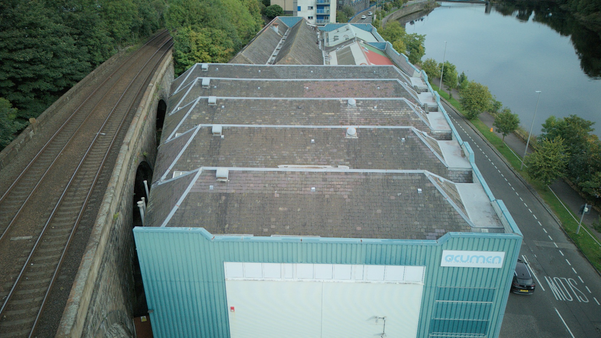
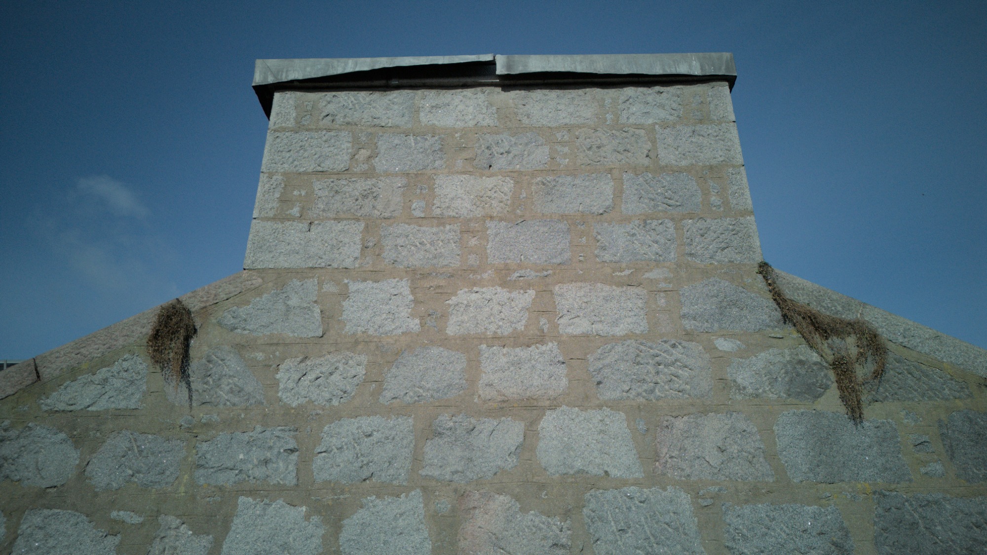
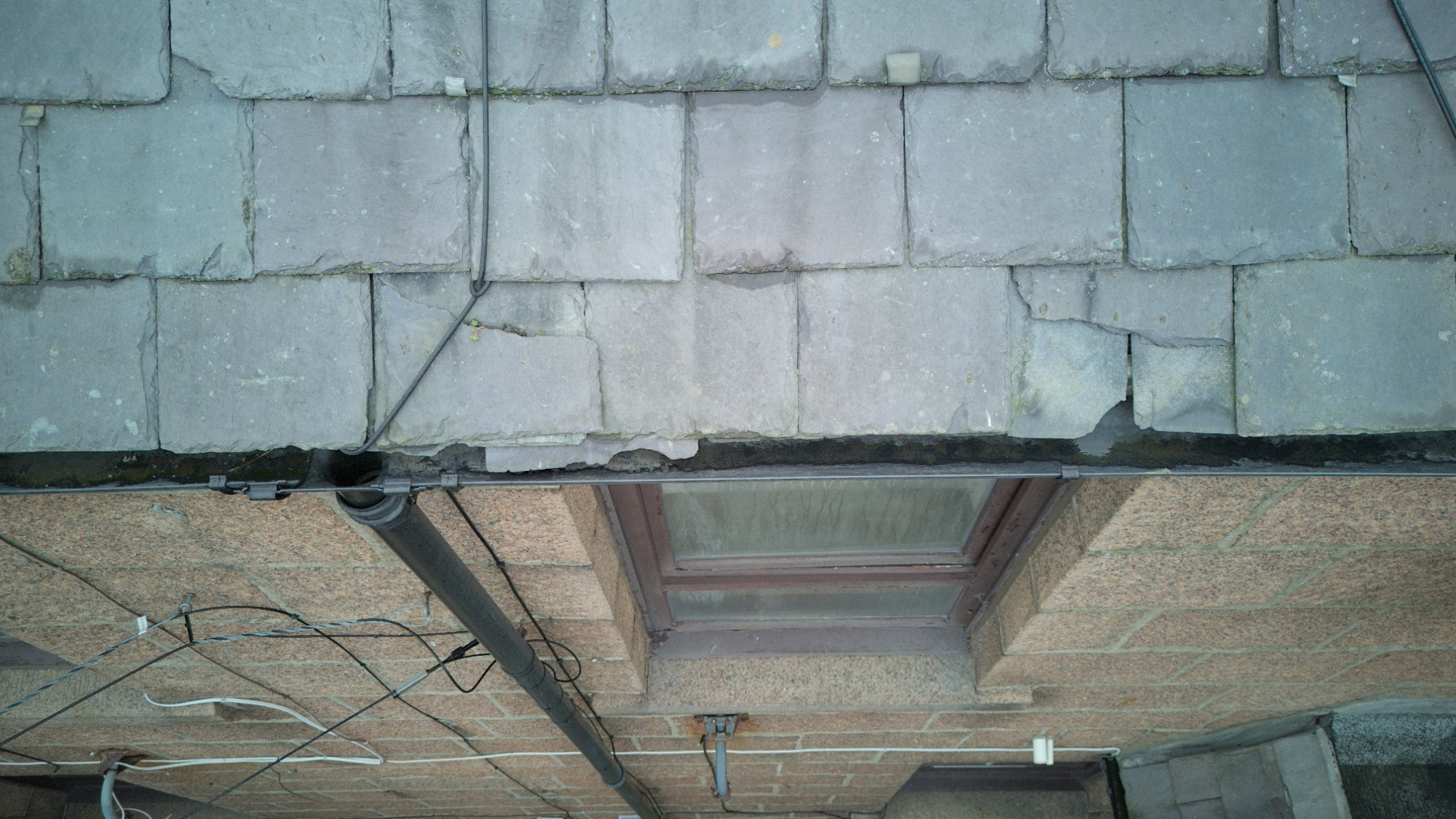
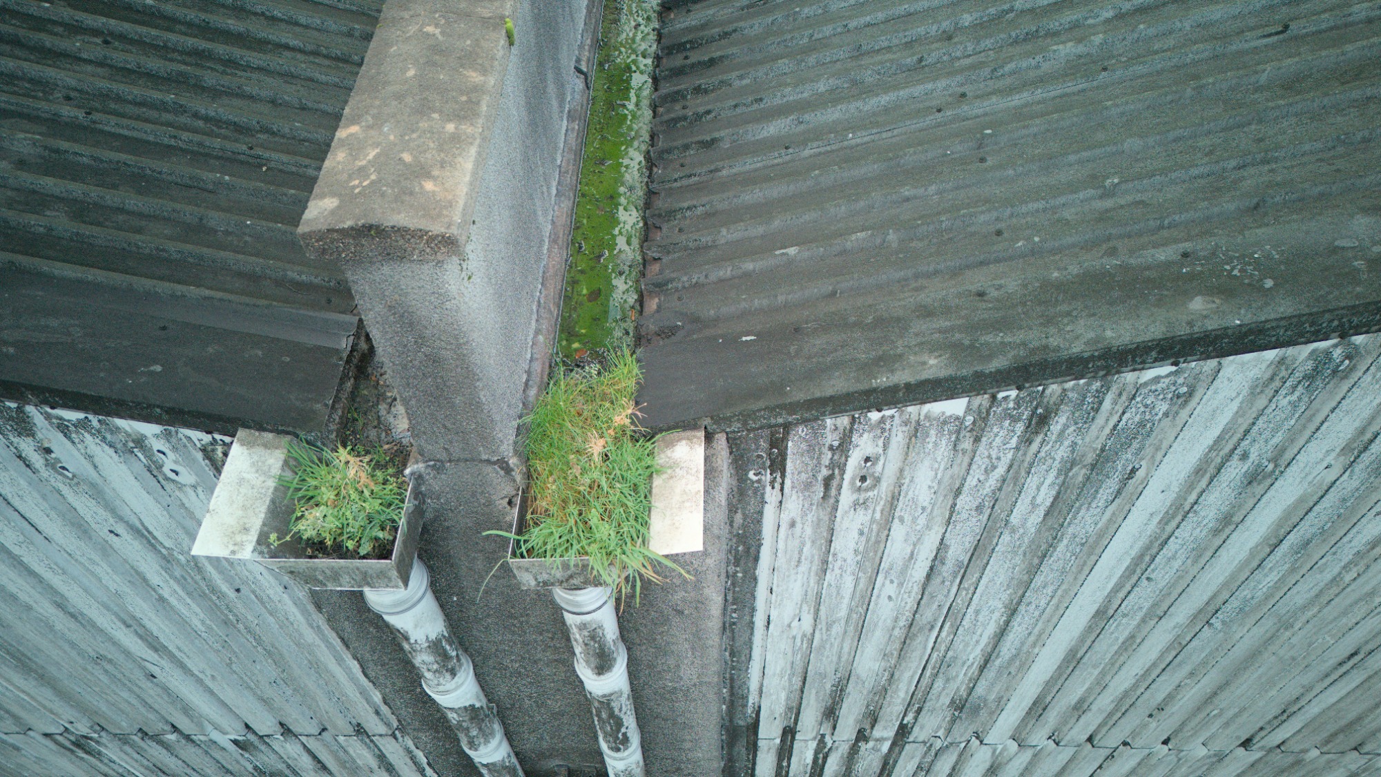
Typical aerial inspection of roof includes following photographs:
- Entire roof from top
- Roof slopes at an angle
- Close up of each roof area
- Close up of each gutter & fascia section
- Close up of roof valleys and ridge lines
- Close up of each roof window
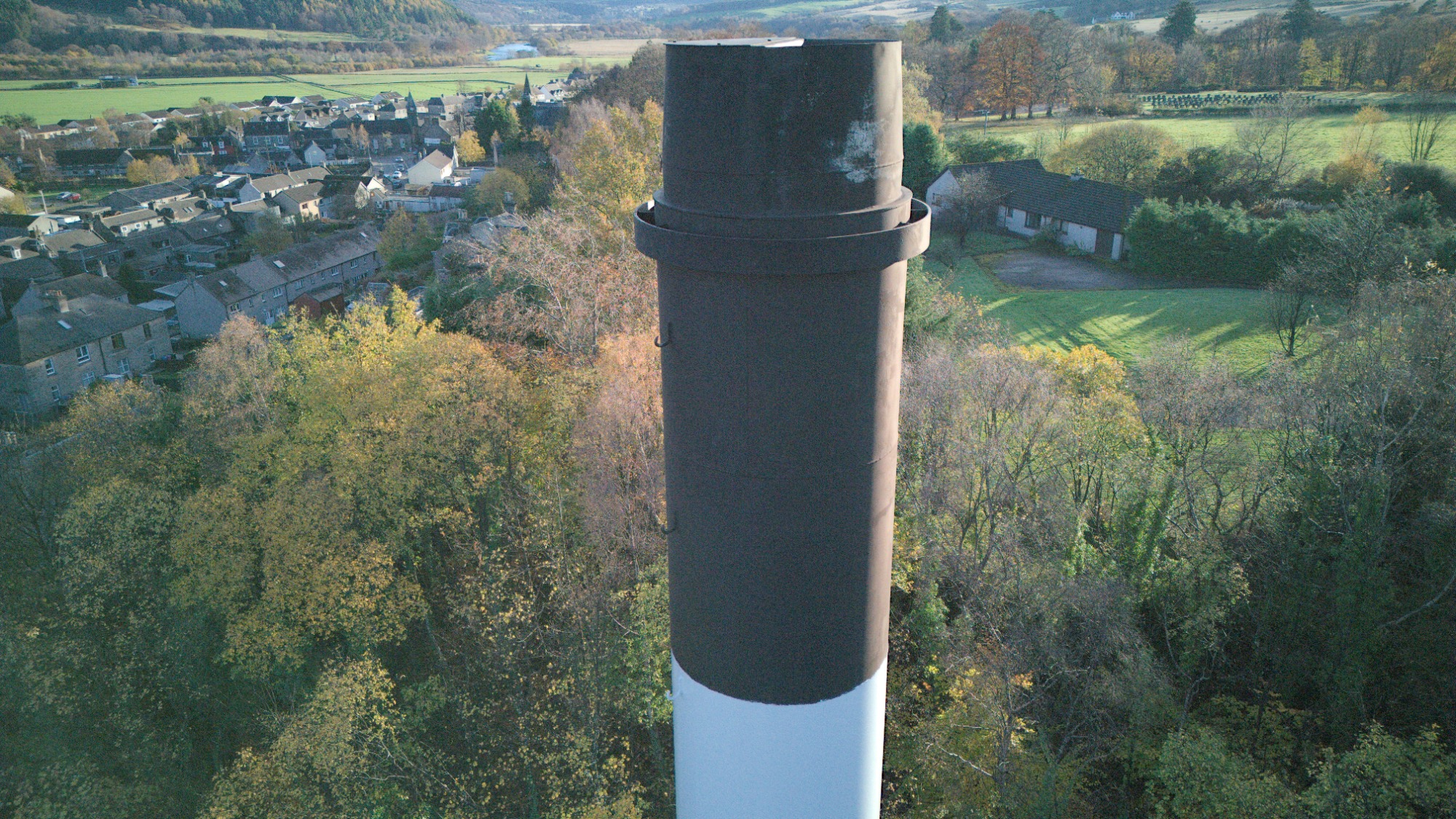
- Each side of chimney, tower
- High-level galleries, walkways and any other elements specifically required
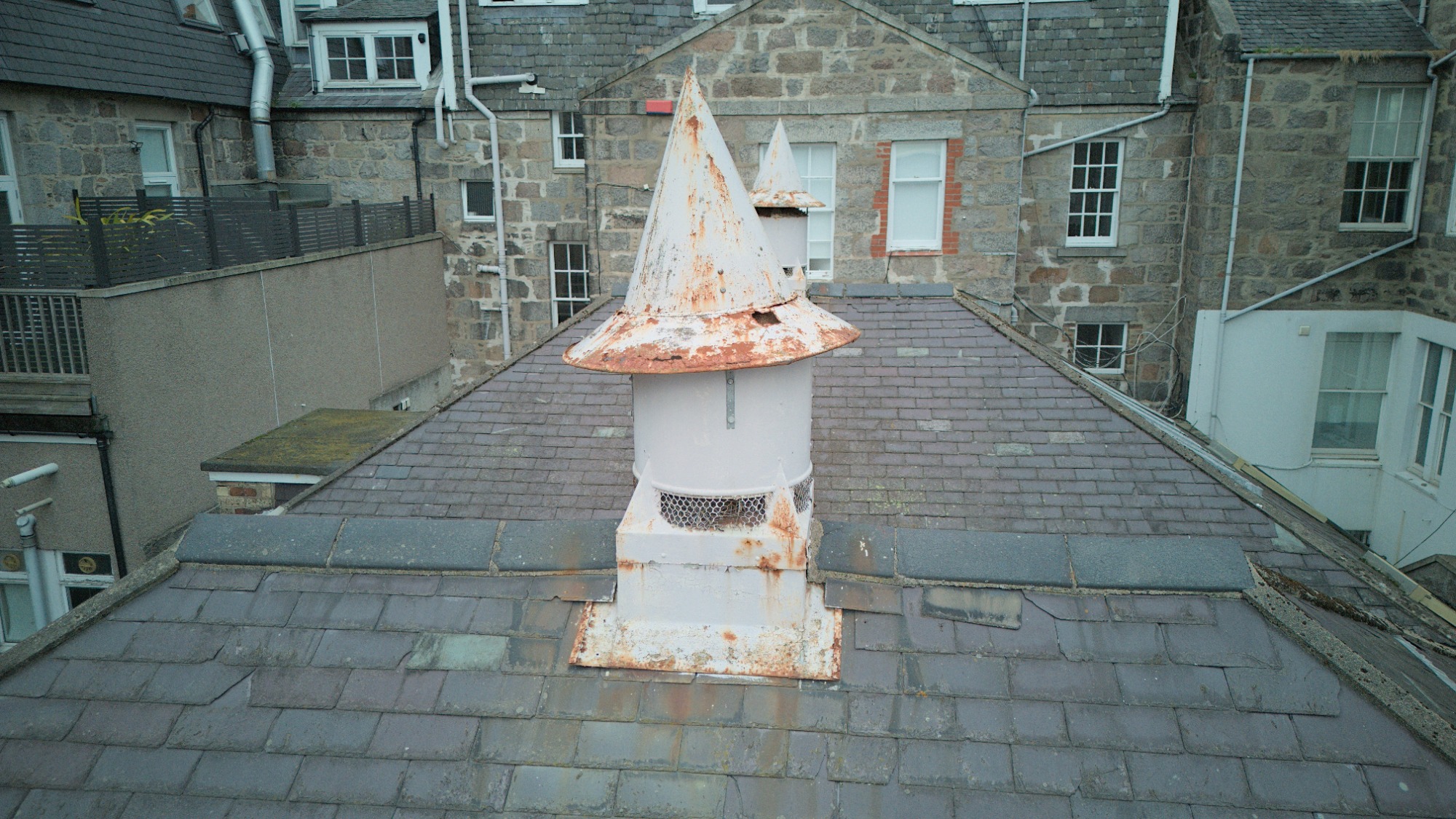
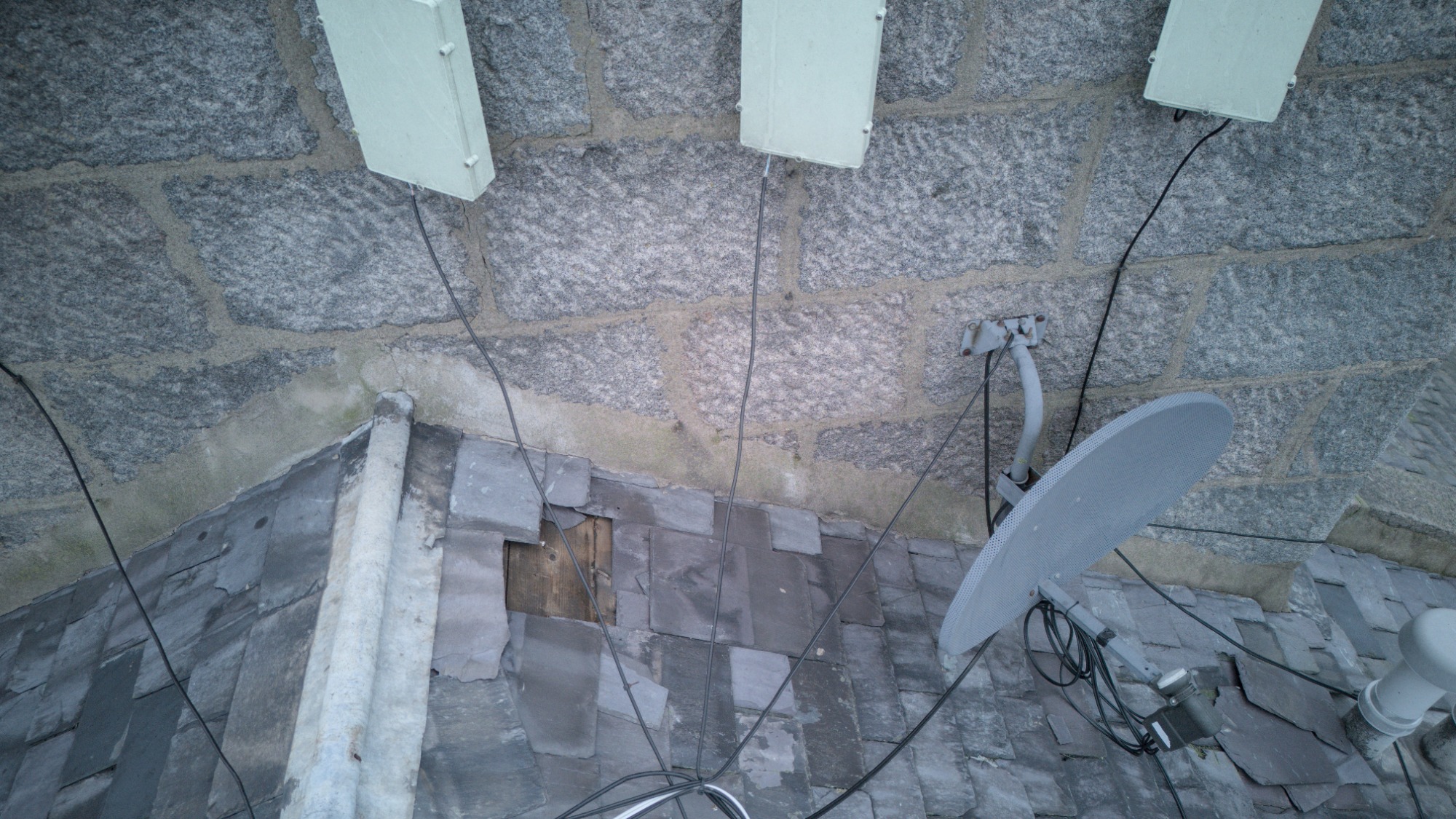
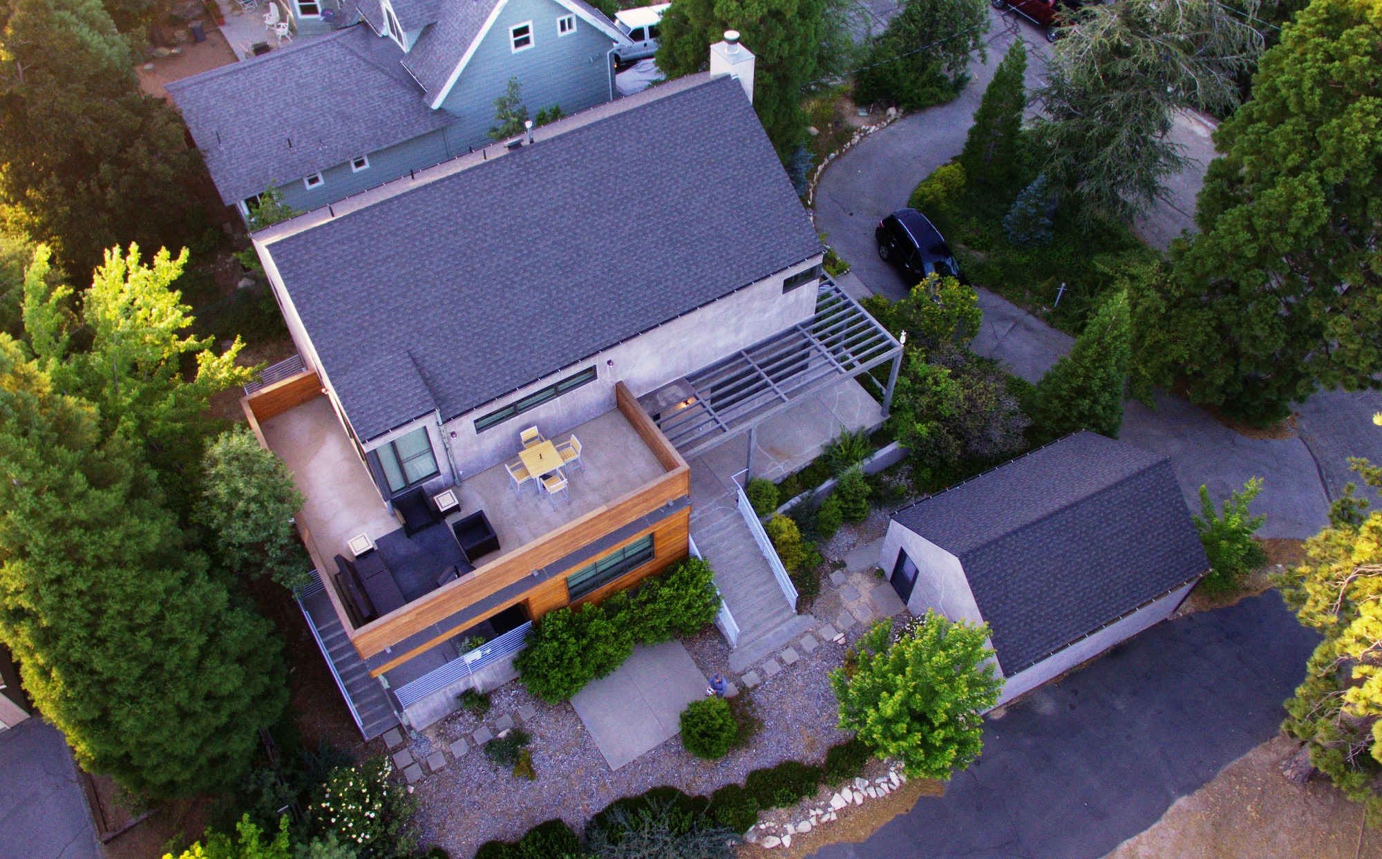
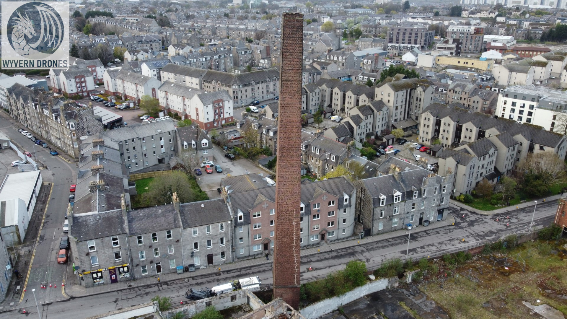
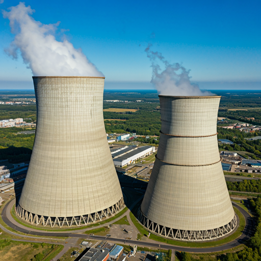
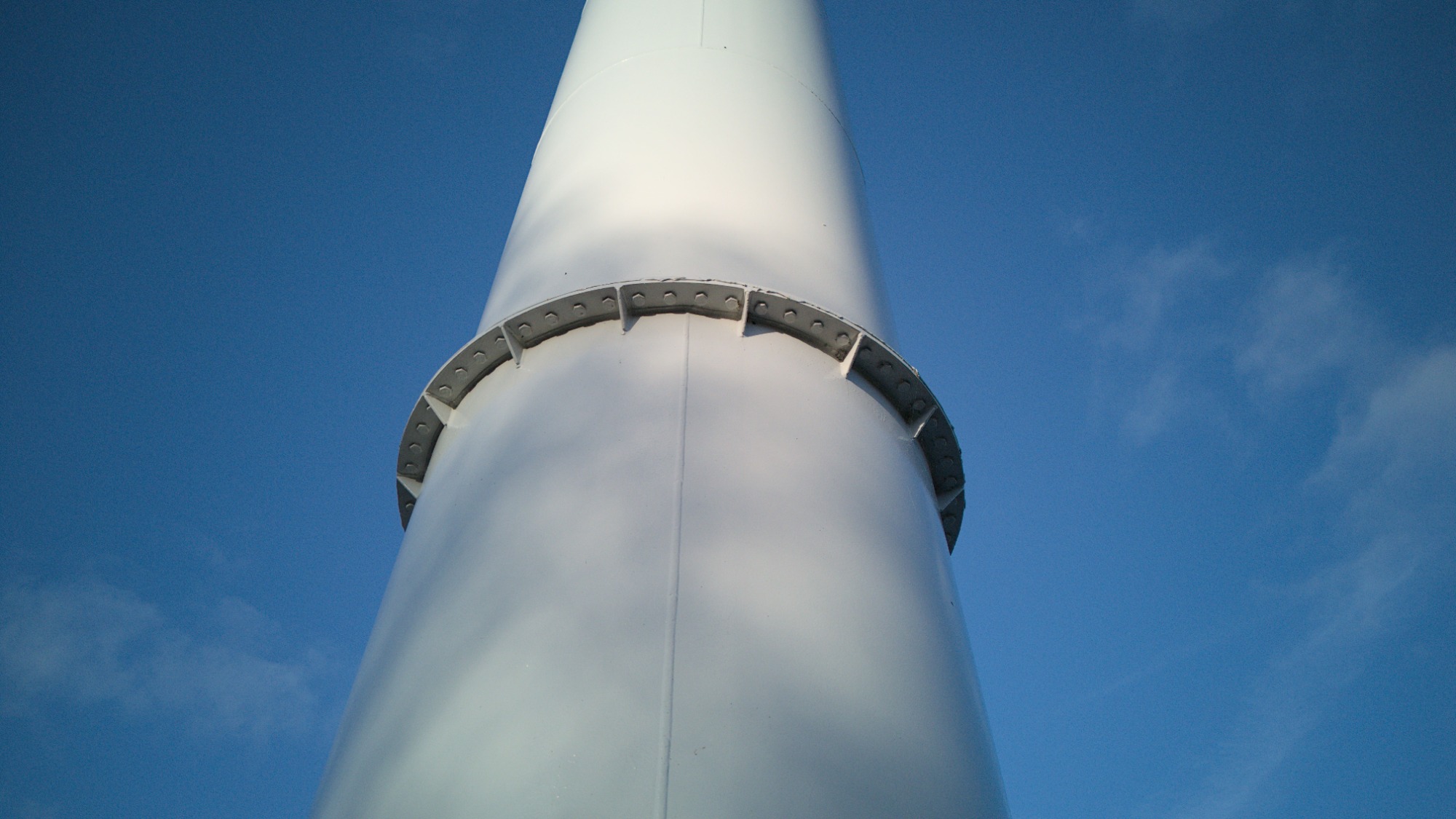
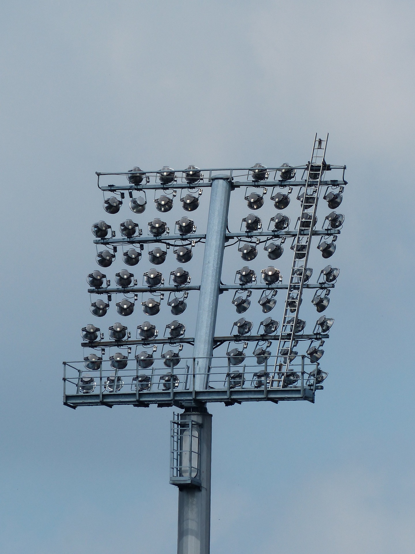
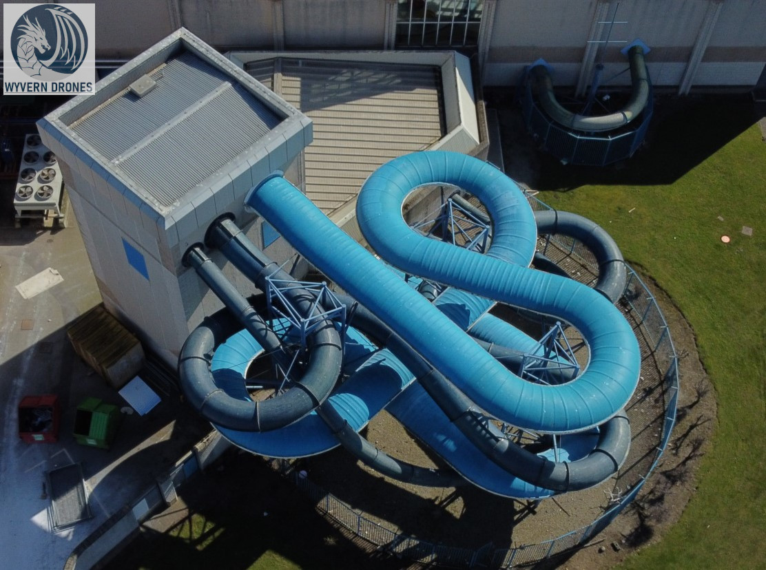
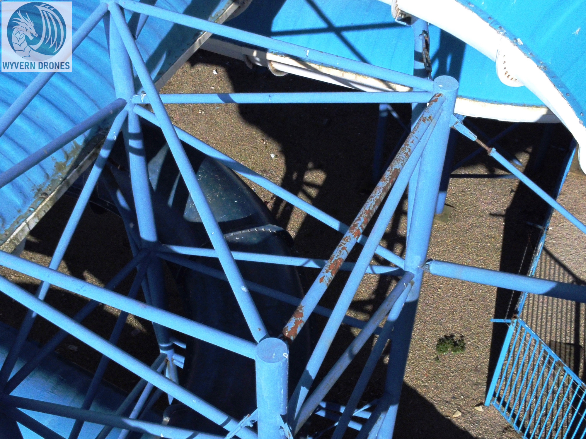
Chimneys and Tall Structures Drone Inspections
Drones are the ideal solution for inspecting high-rise buildings, tall structures, chimneys and stadium floodlights eliminating the risks for inspectors using traditional methods like rope access or scaffolding.
Typical aerial inspection includes following photographs:
- Entire structure from top
- Each elevation from different angles
- Close up of each area of interest

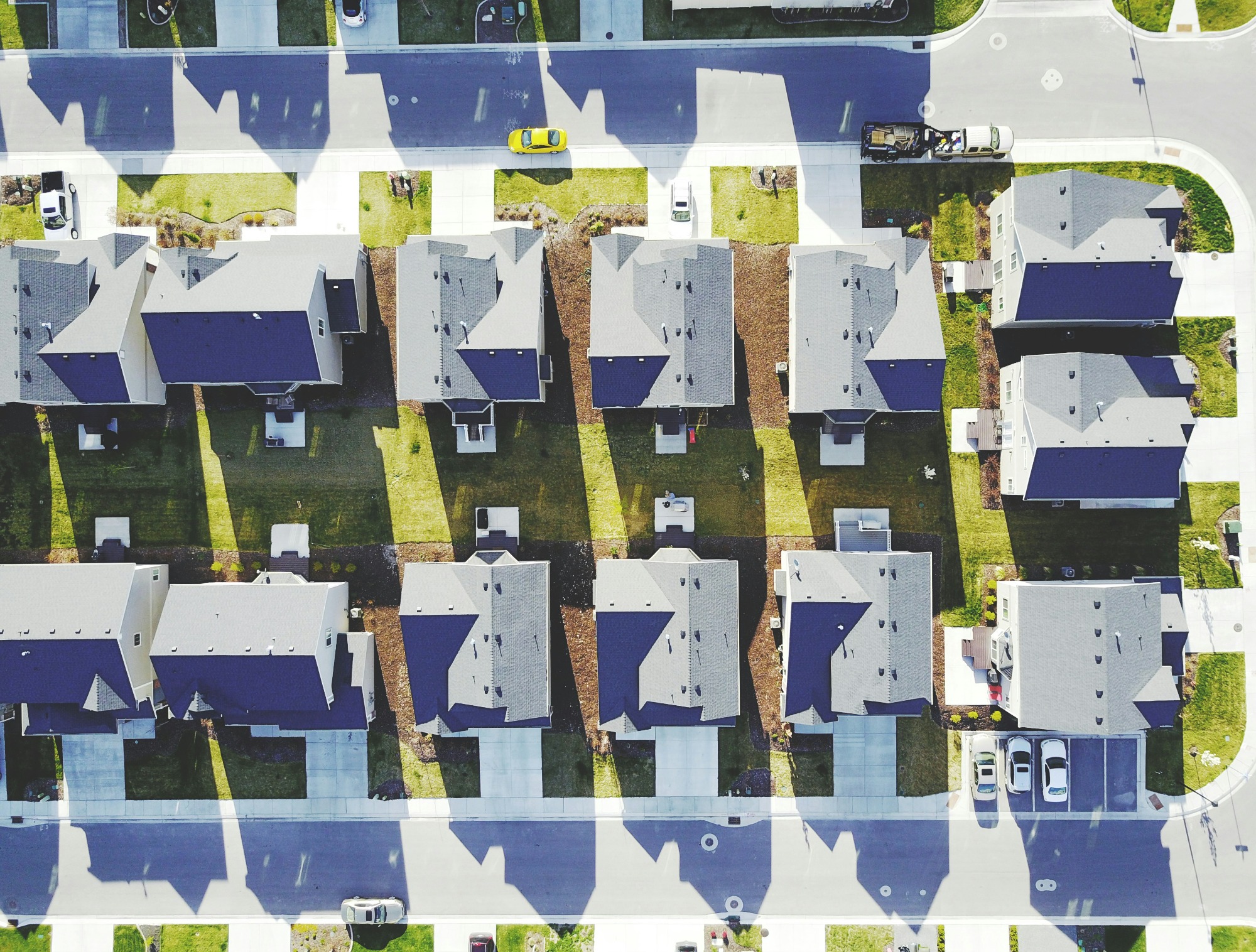
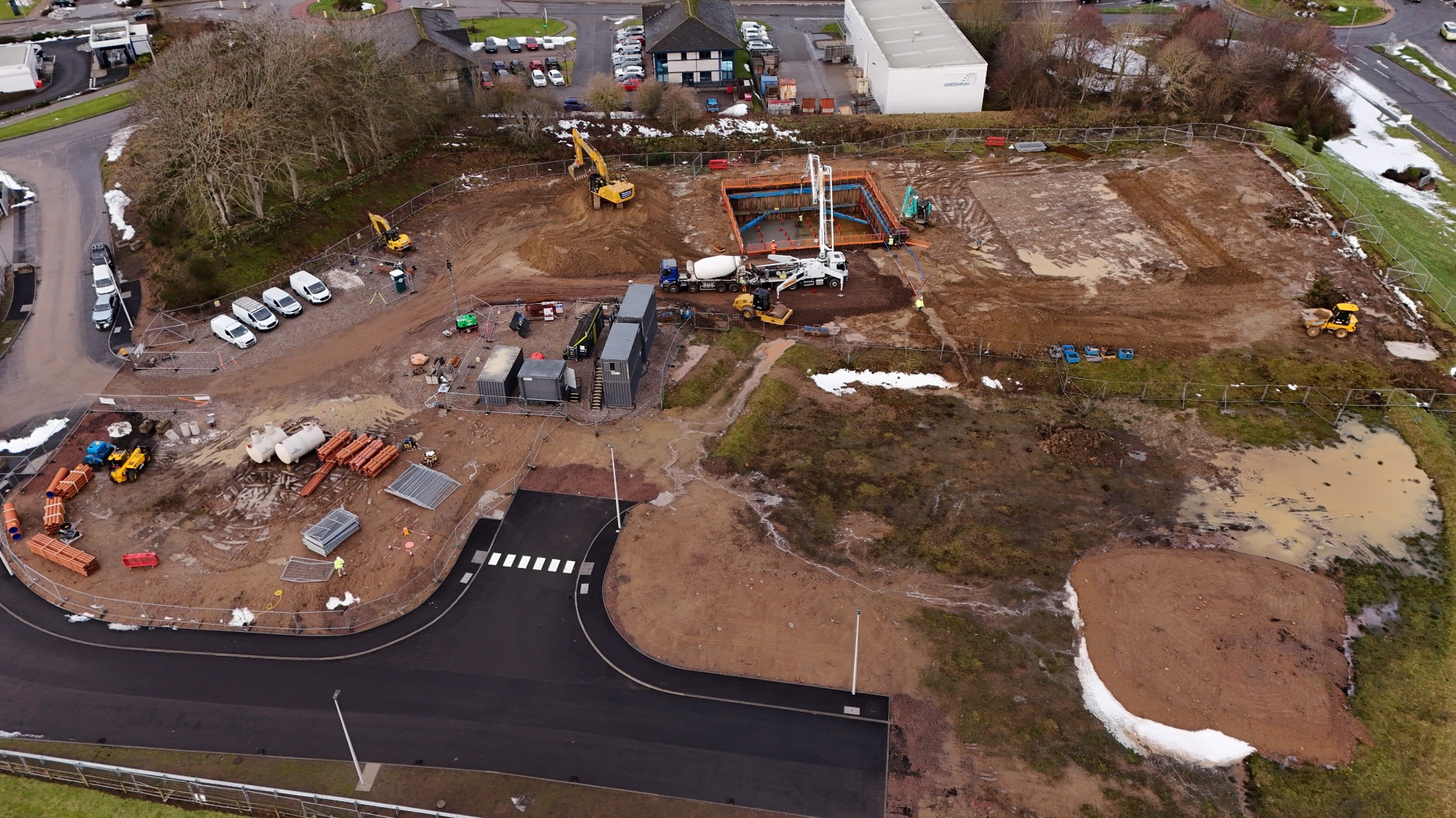
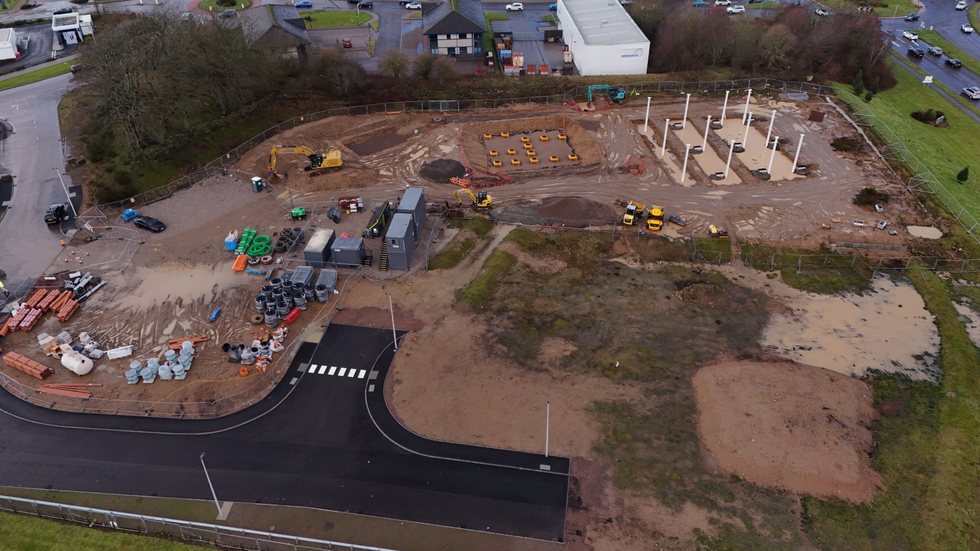
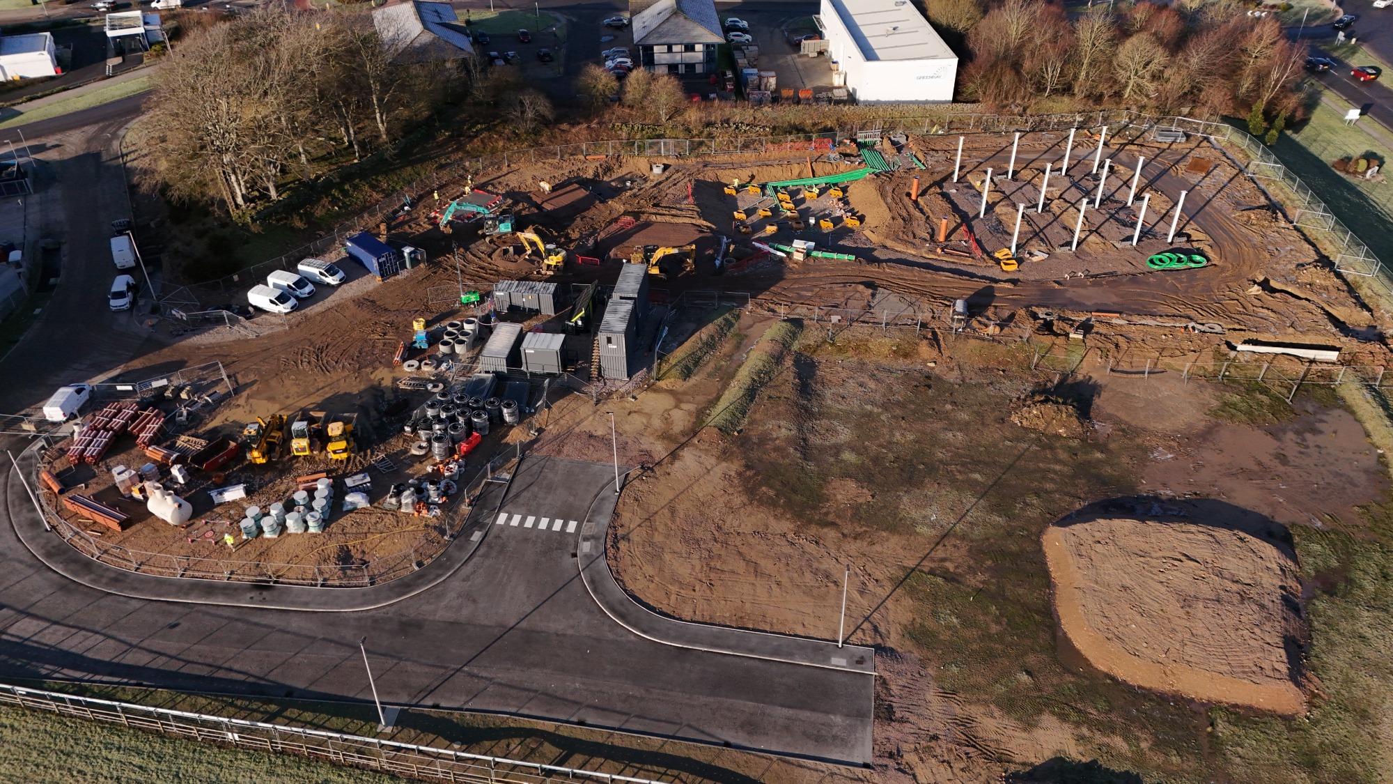
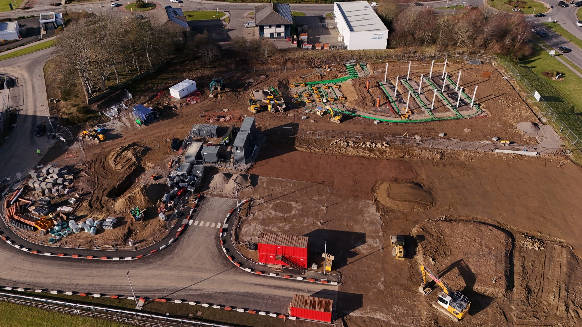
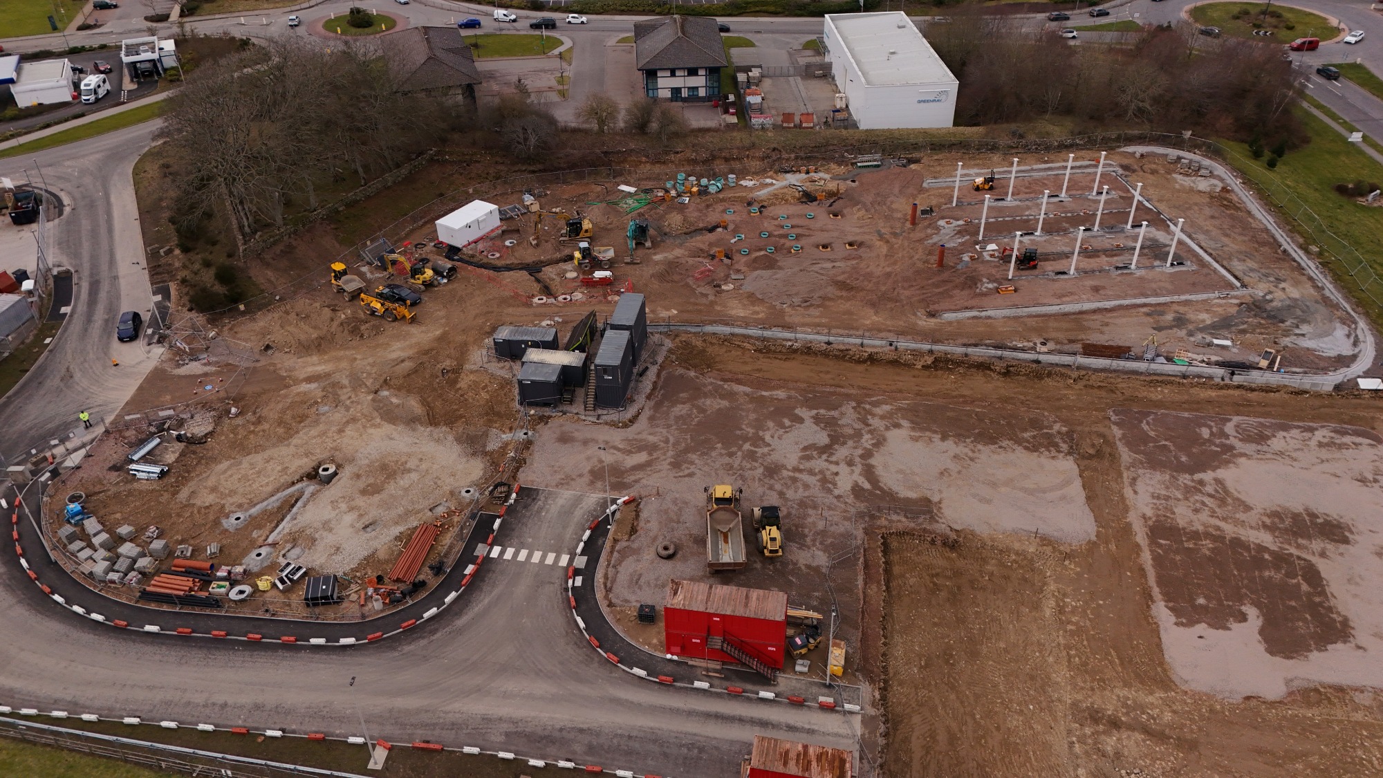
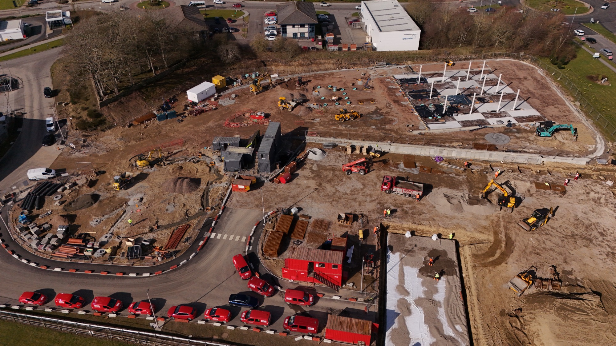
Site Progress Monitoring
In the fast-paced world of construction, visibility is everything. Monitoring site progress through aerial photographs taken at specific time intervals transforms static images into a powerful chronological record of project’s evolution. By automating drone flights to capture the exact same coordinates and angles every week, a seamless visual timeline can be created that bridges the gap between the blueprint and the build.
Typical site progress visit includes following photographs:
- Entire site from top
- Entire site from different locations and angles,
- Close up of each site area
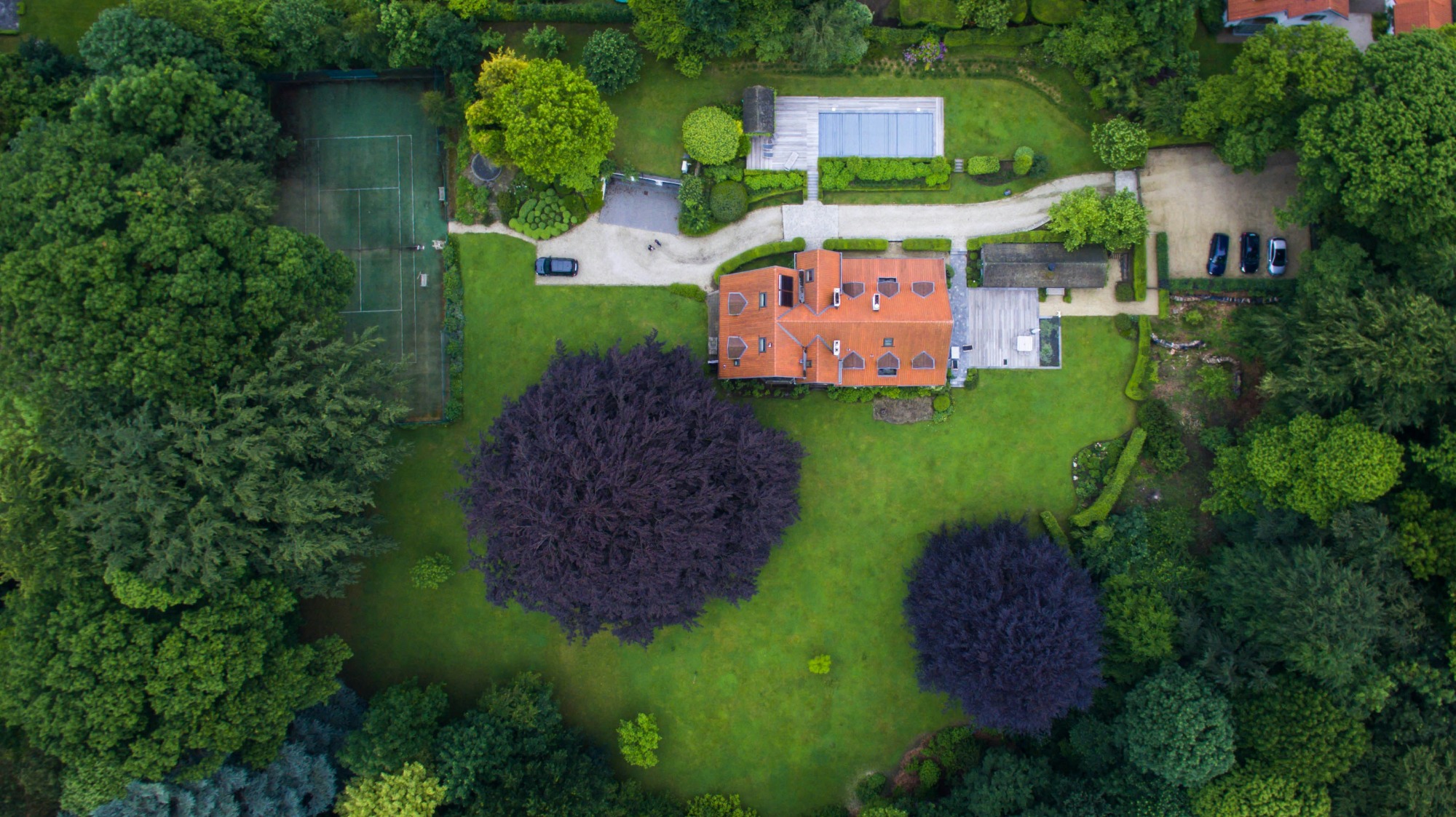
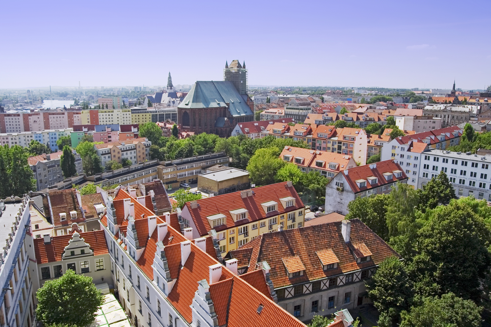
Aerial Real Estate Filming and Photography
Aerial shots and flyovers can significantly enhance promotional videos and photographs for selling real estate. Studies and industry reports show that aerial videos help selling property faster and typically for higher prices. Drones provide a bird's-eye view of the property, showcasing its entire layout, surrounding landscape, and proximity to amenities. This creates a more comprehensive picture for potential buyers compared to ground-level shots.
Typical session includes:
- Complete set of unedited photographs in both RAW & JPG format
- Complete unedited 4K video from flight
Edited photographs and video footage can be provided for an additional fee.